Komptendorf geodata
Komptendorf (Brandenburg) is a populated place; located in Germany in Europe/Berlin (GMT+2) time zone. With population of 521 people, there are 9245 cities with bigger population in this country. Compared to other cities in Germany, 68.7% of cities are located further ↓South; 99.3% of cities are located further ←West and 70.7% of cities have higher elevation than Komptendorf. Note1
Administrative division(s):
- Level 1: Brandenburg
- Level 3: Landkreis Spree-Neiße
- Level 4: Neuhausen/Spree


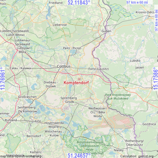
Komptendorf GPS coordinates[2]
51° 41' 4.56" North, 14° 28' 21.828" East
| Map corner | latitude | longitude |
|---|---|---|
| Upper-left | 52.11843°, | 13.76961° |
| Center: | 51.6846°, | 14.47273° |
| Lower-right: | 51.24657°, | 15.17586° |
| Map W x H: | 96.9×96.9 km | = 60.2×60.2mi |
| max Lat: | 55.01917° ⇑31.3% North |
| Komptendorf: | 51.6846° |
| min Lat: | ⇓68.7% South 47.40724° |
| min Long | Komptendorf | max Long |
| 5.92978° | 14.47273° | 14.98853° |
| W 99.3%⇐ | ⇒0.7% E |
Elevation
Elevation of Komptendorf is 87 m = 285 ft, and this is 162.1 m = 532 ft below average elevation for this country.
| Max E: |
1256 m = 4121 ft | 70.7% |
| Avg. | 249.1 m = 817 ft | |
| Komptendorf | 87 m = 285 ft | |
Min E: |
-5 m = -16 ft | 29.3% |
See also: Germany elevation on elevation.city.
Geographical zone
Komptendorf is located in North temperate zone (between Tropic of Cancer and the Arctic Circle). Distance of this North polar circle is 1654.4 km =1028 mi to North.| Distance of | km | miles | from Komptendorf |
|---|---|---|---|
| North Pole | 4260.3 | 2647.2 | to North |
| Arctic Circle | 1654.4 | 1028 | to North |
| Tropic Cancer | 3140.9 | 1951.7 | to South |
| Equator | 5746.8 | 3570.9 | to South |


Nearby cities:
15 places around Komptendorf: (largest is in red/bold)
• Cottbus
12.8 km =8 mi,  309°
309°
• Drebkau
17.5 km =10.9 mi,  258°
258°
• Forst
12.8 km =8 mi,  63°
63°
• Groß Döbbern
10.5 km =6.5 mi,  249°
249°
• Groß Düben
14.6 km =9.1 mi,  153°
153°
• Groß Oßnig
7.9 km =4.9 mi, 264°
• Heinersbrück
15.2 km =9.4 mi,  9°
9°
• Jänschwalde
19.7 km =12.2 mi, 5°
• Kolkwitz
17 km =10.6 mi,  295°
295°
• Laubsdorf
2.4 km =1.5 mi,  241°
241°
• Peitz
19.8 km =12.3 mi,  347°
347°
• Schleife
17.3 km =10.7 mi,  166°
166°
• Spremberg
14.5 km =9 mi,  208°
208°
• Trebendorf
18 km =11.2 mi,  158°
158°
• Tschernitz
15 km =9.3 mi,  138°
138°
Sources, notices
• [Note1] Compared only with cities in Germany existing in our database
• [Src1] Map data: © OpenStreetMap contributors (CC-BY-SA)
• [Src2] Other city data from geonames.org with taken over terms of usage.
• [Src3] Geographical zone / Annual Mean Temperature by Robert A. Rohde @ Wikipedia
