Kleinwelsbach geodata
Kleinwelsbach (Thuringia) is a seat of a fourth-order administrative division; located in Germany in Europe/Berlin (GMT+2) time zone. With population of 135 people, there are 10739 cities with bigger population in this country. Compared to other cities in Germany, 61.2% of cities are located further ↓South; 61.9% of cities are located further ←West and 50.7% of cities have lower elevation than Kleinwelsbach. Note1
Administrative division(s):
- Level 1: Thuringia
- Level 3: Unstrut-Hainich-Kreis
- Level 4: Kleinwelsbach


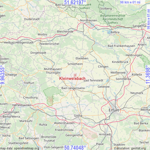
Kleinwelsbach GPS coordinates[2]
51° 10' 59.988" North, 10° 40' 0.012" East
| Map corner | latitude | longitude |
|---|---|---|
| Upper-left | 51.62197°, | 9.96355° |
| Center: | 51.18333°, | 10.66667° |
| Lower-right: | 50.74048°, | 11.3698° |
| Map W x H: | 98×98 km | = 60.9×60.9mi |
| max Lat: | 55.01917° ⇑38.8% North |
| Kleinwelsbach: | 51.18333° |
| min Lat: | ⇓61.2% South 47.40724° |
| min Long | Kleinwelsbach | max Long |
| 5.92978° | 10.66667° | 14.98853° |
| W 61.9%⇐ | ⇒38.1% E |
Elevation
Elevation of Kleinwelsbach is 231 m = 758 ft, and this is 18.1 m = 59 ft below average elevation for this country.
| Max E: |
1256 m = 4121 ft | 49.3% |
| Avg. | 249.1 m = 817 ft | |
| Kleinwelsbach | 231 m = 758 ft | |
Min E: |
-5 m = -16 ft | 50.7% |
See also: Germany elevation on elevation.city.
Geographical zone
Kleinwelsbach is located in North temperate zone (between Tropic of Cancer and the Arctic Circle). Distance of this North polar circle is 1710.1 km =1062.6 mi to North.| Distance of | km | miles | from Kleinwelsbach |
|---|---|---|---|
| North Pole | 4316 | 2681.8 | to North |
| Arctic Circle | 1710.1 | 1062.6 | to North |
| Tropic Cancer | 3085.1 | 1917 | to South |
| Equator | 5691.1 | 3536.3 | to South |


Nearby cities:
15 places around Kleinwelsbach: (largest is in red/bold)
• Altengottern
6.4 km =4 mi,  250°
250°
• Blankenburg
6.1 km =3.8 mi,  72°
72°
• Bothenheilingen
3.5 km =2.2 mi,  270°
270°
• Bruchstedt
8.1 km =5 mi,  90°
90°
• Großengottern
8.3 km =5.2 mi,  241°
241°
• Issersheilingen
2.2 km =1.4 mi,  327°
327°
• Kirchheilingen
2.9 km =1.8 mi, 92°
• Klettstedt
6.9 km =4.3 mi,  122°
122°
• Kutzleben
6.1 km =3.8 mi, 72°
• Körner
7.6 km =4.7 mi,  314°
314°
• Marolterode
5.7 km =3.5 mi,  11°
11°
• Neunheilingen
1.2 km =0.7 mi,  30°
30°
• Schlotheim
7 km =4.3 mi,  355°
355°
• Sundhausen
3.9 km =2.4 mi, 117°
• Tottleben
6.1 km =3.8 mi,  107°
107°
Sources, notices
• [Note1] Compared only with cities in Germany existing in our database
• [Src1] Map data: © OpenStreetMap contributors (CC-BY-SA)
• [Src2] Other city data from geonames.org with taken over terms of usage.
• [Src3] Geographical zone / Annual Mean Temperature by Robert A. Rohde @ Wikipedia
