Klappholz geodata
Klappholz (Schleswig-Holstein) is a seat of a fourth-order administrative division; located in Germany in Europe/Berlin (GMT+2) time zone. With population of 518 people, there are 9265 cities with bigger population in this country. Compared to other cities in Germany, 98.6% of cities are located further ↓South; 57.1% of cities are located further →East and 77% of cities have higher elevation than Klappholz. Note1
Administrative division(s):
- Level 1: Schleswig-Holstein
- Level 3: Kreis Schleswig-Flensburg
- Level 4: Klappholz


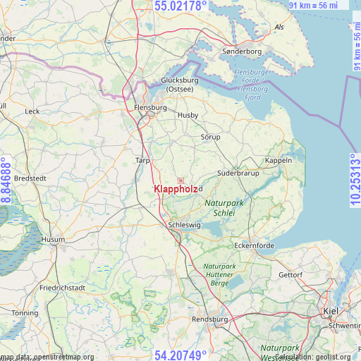
Klappholz GPS coordinates[2]
54° 37' 0.012" North, 9° 33' 0" East
| Map corner | latitude | longitude |
|---|---|---|
| Upper-left | 55.02178°, | 8.84688° |
| Center: | 54.61667°, | 9.55° |
| Lower-right: | 54.20749°, | 10.25313° |
| Map W x H: | 90.5×90.5 km | = 56.2×56.2mi |
| max Lat: | 55.01917° ⇑1.4% North |
| Klappholz: | 54.61667° |
| min Lat: | ⇓98.6% South 47.40724° |
| min Long | Klappholz | max Long |
| 5.92978° | 9.55° | 14.98853° |
| W 42.9%⇐ | ⇒57.1% E |
Elevation
Elevation of Klappholz is 56 m = 184 ft, and this is 193.1 m = 634 ft below average elevation for this country.
| Max E: |
1256 m = 4121 ft | 77% |
| Avg. | 249.1 m = 817 ft | |
| Klappholz | 56 m = 184 ft | |
Min E: |
-5 m = -16 ft | 23% |
See also: Germany elevation on elevation.city.
Geographical zone
Klappholz is located in North temperate zone (between Tropic of Cancer and the Arctic Circle). Distance of this North polar circle is 1328.4 km =825.4 mi to North.| Distance of | km | miles | from Klappholz |
|---|---|---|---|
| North Pole | 3934.3 | 2444.7 | to North |
| Arctic Circle | 1328.4 | 825.4 | to North |
| Tropic Cancer | 3466.9 | 2154.2 | to South |
| Equator | 6072.8 | 3773.5 | to South |


Nearby cities:
15 places around Klappholz: (largest is in red/bold)
• Böklund
2.8 km =1.7 mi,  130°
130°
• Havetoft
4.3 km =2.7 mi,  329°
329°
• Havetoftloit
5 km =3.1 mi,  6°
6°
• Idstedt
4.3 km =2.7 mi,  210°
210°
• Lürschau
8.1 km =5 mi,  203°
203°
• Neuberend
7.5 km =4.7 mi,  188°
188°
• Nübel
6 km =3.7 mi,  158°
158°
• Schnarup-Thumby
7.4 km =4.6 mi,  60°
60°
• Sieverstedt
5.9 km =3.7 mi,  297°
297°
• Stolk
1.9 km =1.2 mi,  180°
180°
• Struxdorf
5.9 km =3.7 mi,  74°
74°
• Süderfahrenstedt
4.3 km =2.7 mi,  149°
149°
• Tolk
7 km =4.3 mi, 125°
• Twedt
8.8 km =5.5 mi,  102°
102°
• Ülsby
3.7 km =2.3 mi, 60°
Sources, notices
• [Note1] Compared only with cities in Germany existing in our database
• [Src1] Map data: © OpenStreetMap contributors (CC-BY-SA)
• [Src2] Other city data from geonames.org with taken over terms of usage.
• [Src3] Geographical zone / Annual Mean Temperature by Robert A. Rohde @ Wikipedia
