Schnarup-Thumby geodata
Schnarup-Thumby (Schleswig-Holstein) is a seat of a fourth-order administrative division; located in Germany in Europe/Berlin (GMT+2) time zone. With population of 598 people, there are 8837 cities with bigger population in this country. Compared to other cities in Germany, 98.9% of cities are located further ↓South; 55.3% of cities are located further →East and 85.8% of cities have higher elevation than Schnarup-Thumby. Note1
Administrative division(s):
- Level 1: Schleswig-Holstein
- Level 3: Kreis Schleswig-Flensburg
- Level 4: Schnarup-Thumby


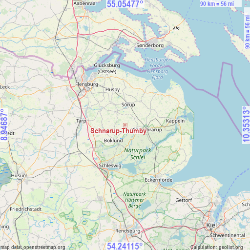
Schnarup-Thumby GPS coordinates[2]
54° 39' 0" North, 9° 39' 0" East
| Map corner | latitude | longitude |
|---|---|---|
| Upper-left | 55.05477°, | 8.94687° |
| Center: | 54.65°, | 9.65° |
| Lower-right: | 54.24115°, | 10.35313° |
| Map W x H: | 90.5×90.5 km | = 56.2×56.2mi |
| max Lat: | 55.01917° ⇑1.1% North |
| Schnarup-Thumby: | 54.65° |
| min Lat: | ⇓98.9% South 47.40724° |
| min Long | Schnarup-Thumby | max Long |
| 5.92978° | 9.65° | 14.98853° |
| W 44.7%⇐ | ⇒55.3% E |
Elevation
Elevation of Schnarup-Thumby is 33 m = 108 ft, and this is 216.1 m = 709 ft below average elevation for this country.
| Max E: |
1256 m = 4121 ft | 85.8% |
| Avg. | 249.1 m = 817 ft | |
| Schnarup-Thumby | 33 m = 108 ft | |
Min E: |
-5 m = -16 ft | 14.2% |
See also: Germany elevation on elevation.city.
Geographical zone
Schnarup-Thumby is located in North temperate zone (between Tropic of Cancer and the Arctic Circle). Distance of this North polar circle is 1324.7 km =823.1 mi to North.| Distance of | km | miles | from Schnarup-Thumby |
|---|---|---|---|
| North Pole | 3930.6 | 2442.4 | to North |
| Arctic Circle | 1324.7 | 823.1 | to North |
| Tropic Cancer | 3470.6 | 2156.5 | to South |
| Equator | 6076.5 | 3775.8 | to South |


Nearby cities:
15 places around Schnarup-Thumby: (largest is in red/bold)
• Brebel
6.7 km =4.2 mi,  106°
106°
• Böel
4.3 km =2.7 mi,  90°
90°
• Böklund
7 km =4.3 mi,  217°
217°
• Havetoftloit
6 km =3.7 mi,  282°
282°
• Klappholz
7.4 km =4.6 mi,  240°
240°
• Loit
4.9 km =3 mi,  139°
139°
• Mohrkirch
4.7 km =2.9 mi,  66°
66°
• Norderbrarup
7.6 km =4.7 mi, 86°
• Satrup
5.5 km =3.4 mi,  328°
328°
• Saustrup
7.7 km =4.8 mi,  76°
76°
• Struxdorf
2.2 km =1.4 mi,  199°
199°
• Sörup
7.5 km =4.7 mi,  8°
8°
• Tolk
7.8 km =4.8 mi,  185°
185°
• Twedt
6 km =3.7 mi,  158°
158°
• Ülsby
3.7 km =2.3 mi, 240°
Sources, notices
• [Note1] Compared only with cities in Germany existing in our database
• [Src1] Map data: © OpenStreetMap contributors (CC-BY-SA)
• [Src2] Other city data from geonames.org with taken over terms of usage.
• [Src3] Geographical zone / Annual Mean Temperature by Robert A. Rohde @ Wikipedia
