Kirchlengern geodata
Kirchlengern (North Rhine-Westphalia) is a seat of a fourth-order administrative division; located in Germany in Europe/Berlin (GMT+2) time zone. With population of 16,338 people, there are 971 cities with bigger population in this country. Compared to other cities in Germany, 74.1% of cities are located further ↓South; 69.8% of cities are located further →East and 74.7% of cities have higher elevation than Kirchlengern. Note1
Administrative division(s):
- Level 1: North Rhine-Westphalia
- Level 2: Regierungsbezirk Detmold
- Level 3: Kreis Herford
- Level 4: Kirchlengern


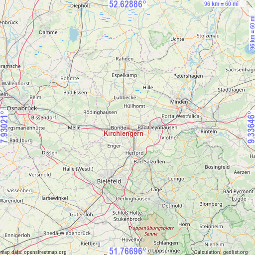
Kirchlengern GPS coordinates[2]
52° 12' 0" North, 8° 37' 59.988" East
| Map corner | latitude | longitude |
|---|---|---|
| Upper-left | 52.62886°, | 7.93021° |
| Center: | 52.2°, | 8.63333° |
| Lower-right: | 51.76696°, | 9.33646° |
| Map W x H: | 95.8×95.8 km | = 59.5×59.5mi |
| max Lat: | 55.01917° ⇑25.9% North |
| Kirchlengern: | 52.2° |
| min Lat: | ⇓74.1% South 47.40724° |
| min Long | Kirchlengern | max Long |
| 5.92978° | 8.63333° | 14.98853° |
| W 30.2%⇐ | ⇒69.8% E |
Elevation
Elevation of Kirchlengern is 64 m = 210 ft, and this is 185.1 m = 607 ft below average elevation for this country.
| Max E: |
1256 m = 4121 ft | 74.7% |
| Avg. | 249.1 m = 817 ft | |
| Kirchlengern | 64 m = 210 ft | |
Min E: |
-5 m = -16 ft | 25.3% |
See also: Germany elevation on elevation.city.
Geographical zone
Kirchlengern is located in North temperate zone (between Tropic of Cancer and the Arctic Circle). Distance of this North polar circle is 1597.1 km =992.4 mi to North.| Distance of | km | miles | from Kirchlengern |
|---|---|---|---|
| North Pole | 4203 | 2611.6 | to North |
| Arctic Circle | 1597.1 | 992.4 | to North |
| Tropic Cancer | 3198.2 | 1987.3 | to South |
| Equator | 5804.1 | 3606.5 | to South |


Nearby cities:
15 places around Kirchlengern: (largest is in red/bold)
• Bad Holzhausen
11.8 km =7.3 mi,  327°
327°
• Bad Oeynhausen
11.6 km =7.2 mi,  86°
86°
• Bad Salzuflen
14.7 km =9.1 mi,  149°
149°
• Bünde
3.2 km =2 mi,  266°
266°
• Enger
8.4 km =5.2 mi,  217°
217°
• Herford
9.9 km =6.2 mi,  163°
163°
• Hiddenhausen
3.9 km =2.4 mi,  197°
197°
• Hüllhorst
9.5 km =5.9 mi,  13°
13°
• Löhne
4.2 km =2.6 mi,  107°
107°
• Lübbecke
12 km =7.5 mi,  353°
353°
• Obernbeck
4.8 km =3 mi, 87°
• Preußisch Oldendorf
15.1 km =9.4 mi,  321°
321°
• Rödinghausen
11.6 km =7.2 mi,  298°
298°
• Spenge
12.1 km =7.5 mi,  236°
236°
• Vlotho
15.9 km =9.9 mi,  104°
104°
Sources, notices
• [Note1] Compared only with cities in Germany existing in our database
• [Src1] Map data: © OpenStreetMap contributors (CC-BY-SA)
• [Src2] Other city data from geonames.org with taken over terms of usage.
• [Src3] Geographical zone / Annual Mean Temperature by Robert A. Rohde @ Wikipedia
