Kinderbeuern geodata
Kinderbeuern (Rheinland-Pfalz) is a seat of a fourth-order administrative division; located in Germany in Europe/Berlin (GMT+2) time zone. With population of 1,119 people, there are 6795 cities with bigger population in this country. Compared to other cities in Germany, 63.6% of cities are located further ↑North; 93% of cities are located further →East and 58.5% of cities have higher elevation than Kinderbeuern. Note1
Administrative division(s):
- Level 1: Rheinland-Pfalz
- Level 3: Landkreis Bernkastel-Wittlich
- Level 4: Kinderbeuern


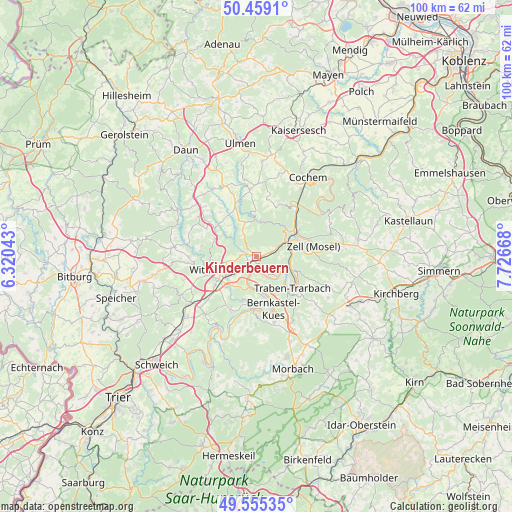
Kinderbeuern GPS coordinates[2]
50° 0' 33.66" North, 7° 1' 24.78" East
| Map corner | latitude | longitude |
|---|---|---|
| Upper-left | 50.4591°, | 6.32043° |
| Center: | 50.00935°, | 7.02355° |
| Lower-right: | 49.55535°, | 7.72668° |
| Map W x H: | 100.5×100.5 km | = 62.4×62.4mi |
| max Lat: | 55.01917° ⇑63.6% North |
| Kinderbeuern: | 50.00935° |
| min Lat: | ⇓36.4% South 47.40724° |
| min Long | Kinderbeuern | max Long |
| 5.92978° | 7.02355° | 14.98853° |
| W 7%⇐ | ⇒93% E |
Elevation
Elevation of Kinderbeuern is 164 m = 538 ft, and this is 85.1 m = 279 ft below average elevation for this country.
| Max E: |
1256 m = 4121 ft | 58.5% |
| Avg. | 249.1 m = 817 ft | |
| Kinderbeuern | 164 m = 538 ft | |
Min E: |
-5 m = -16 ft | 41.5% |
See also: Germany elevation on elevation.city.
Geographical zone
Kinderbeuern is located in North temperate zone (between Tropic of Cancer and the Arctic Circle). Distance of this North polar circle is 1840.7 km =1143.8 mi to North.| Distance of | km | miles | from Kinderbeuern |
|---|---|---|---|
| North Pole | 4446.5 | 2762.9 | to North |
| Arctic Circle | 1840.7 | 1143.8 | to North |
| Tropic Cancer | 2954.6 | 1835.9 | to South |
| Equator | 5560.5 | 3455.1 | to South |


Nearby cities:
15 places around Kinderbeuern: (largest is in red/bold)
• Bad Bertrich
6.4 km =4 mi,  6°
6°
• Bausendorf
1.9 km =1.2 mi,  295°
295°
• Bengel
3.2 km =2 mi,  75°
75°
• Diefenbach
5.9 km =3.7 mi, 296°
• Erden
2.9 km =1.8 mi,  189°
189°
• Flußbach
6.5 km =4 mi,  277°
277°
• Hontheim
7 km =4.3 mi,  335°
335°
• Kinheim
5.1 km =3.2 mi,  158°
158°
• Kröv
5.2 km =3.2 mi,  124°
124°
• Lösnich
4.1 km =2.5 mi, 160°
• Neuerburg
5.5 km =3.4 mi,  260°
260°
• Reil
6.7 km =4.2 mi, 83°
• Willwerscheid
7 km =4.3 mi,  292°
292°
• Zeltingen-Rachtig
6.6 km =4.1 mi,  184°
184°
• Ürzig
3.6 km =2.2 mi,  200°
200°
Sources, notices
• [Note1] Compared only with cities in Germany existing in our database
• [Src1] Map data: © OpenStreetMap contributors (CC-BY-SA)
• [Src2] Other city data from geonames.org with taken over terms of usage.
• [Src3] Geographical zone / Annual Mean Temperature by Robert A. Rohde @ Wikipedia
