Kerschenbach geodata
Kerschenbach (Rheinland-Pfalz) is a seat of a fourth-order administrative division; located in Germany in Europe/Berlin (GMT+2) time zone. With population of 190 people, there are 10516 cities with bigger population in this country. Compared to other cities in Germany, 55.7% of cities are located further ↑North; 97.8% of cities are located further →East and 89.2% of cities have lower elevation than Kerschenbach. Note1


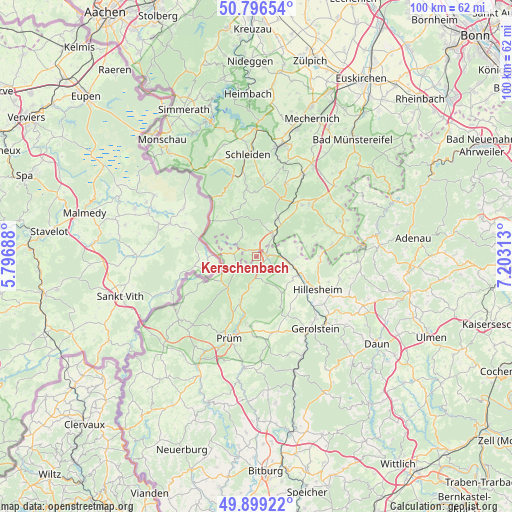
Kerschenbach GPS coordinates[2]
50° 21' 0" North, 6° 30' 0" East
| Map corner | latitude | longitude |
|---|---|---|
| Upper-left | 50.79654°, | 5.79688° |
| Center: | 50.35°, | 6.5° |
| Lower-right: | 49.89922°, | 7.20313° |
| Map W x H: | 99.8×99.8 km | = 62×62mi |
| max Lat: | 55.01917° ⇑55.7% North |
| Kerschenbach: | 50.35° |
| min Lat: | ⇓44.3% South 47.40724° |
| min Long | Kerschenbach | max Long |
| 5.92978° | 6.5° | 14.98853° |
| W 2.2%⇐ | ⇒97.8% E |
Elevation
Elevation of Kerschenbach is 505 m = 1657 ft, and this is 255.9 m = 840 ft above average elevation for this country.
| Max E: |
1256 m = 4121 ft | 10.8% |
| Kerschenbach | 505 m 1657 ft | |
| Avg. | 249.1 m = 817 ft | |
Min E: |
-5 m = -16 ft | 89.2% |
See also: Germany elevation on elevation.city.
Geographical zone
Kerschenbach is located in North temperate zone (between Tropic of Cancer and the Arctic Circle). Distance of this North polar circle is 1802.8 km =1120.2 mi to North.| Distance of | km | miles | from Kerschenbach |
|---|---|---|---|
| North Pole | 4408.7 | 2739.4 | to North |
| Arctic Circle | 1802.8 | 1120.2 | to North |
| Tropic Cancer | 2992.5 | 1859.5 | to South |
| Equator | 5598.4 | 3478.7 | to South |


Nearby cities:
15 places around Kerschenbach: (largest is in red/bold)
• Basberg
9 km =5.6 mi,  128°
128°
• Dahlem
5.2 km =3.2 mi,  40°
40°
• Esch
8.5 km =5.3 mi,  77°
77°
• Feusdorf
8.3 km =5.2 mi,  90°
90°
• Gönnersdorf
7.3 km =4.5 mi,  104°
104°
• Hallschlag
4.4 km =2.7 mi,  276°
276°
• Jünkerath
5.8 km =3.6 mi, 96°
• Lissendorf
8 km =5 mi,  117°
117°
• Neuendorf
7.8 km =4.8 mi,  197°
197°
• Ormont
4.9 km =3 mi,  237°
237°
• Reuth
5.7 km =3.5 mi,  192°
192°
• Scheid
5.6 km =3.5 mi, 280°
• Schüller
6.2 km =3.9 mi,  107°
107°
• Stadtkyll
2.4 km =1.5 mi, 90°
• Steffeln
8.8 km =5.5 mi,  147°
147°
Sources, notices
• [Note1] Compared only with cities in Germany existing in our database
• [Src1] Map data: © OpenStreetMap contributors (CC-BY-SA)
• [Src2] Other city data from geonames.org with taken over terms of usage.
• [Src3] Geographical zone / Annual Mean Temperature by Robert A. Rohde @ Wikipedia
