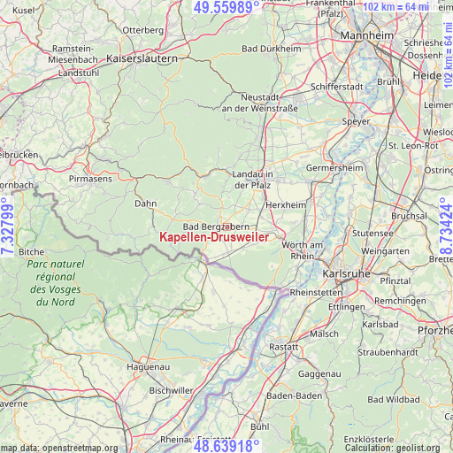
Kapellen-Drusweiler geodata
Kapellen-Drusweiler (Rheinland-Pfalz) is a seat of a fourth-order administrative division; located in Germany in Europe/Berlin (GMT+2) time zone. With population of 888 people, there are 7567 cities with bigger population in this country. Compared to other cities in Germany, 81.7% of cities are located further ↑North; 76.6% of cities are located further →East and 58.2% of cities have higher elevation than Kapellen-Drusweiler. Note1
Administrative division(s):
- Level 1: Rheinland-Pfalz
- Level 3: Landkreis Südliche Weinstraße
- Level 4: Kapellen-Drusweiler


Kapellen-Drusweiler GPS coordinates[2]
49° 6' 6.012" North, 8° 1' 51.996" East
| Map corner | latitude | longitude |
|---|---|---|
| Upper-left | 49.55989°, | 7.32799° |
| Center: | 49.10167°, | 8.03111° |
| Lower-right: | 48.63918°, | 8.73424° |
| Map W x H: | 102.4×102.4 km | = 63.6×63.6mi |
| max Lat: | 55.01917° ⇑81.7% North |
| Kapellen-Drusweiler: | 49.10167° |
| min Lat: | ⇓18.3% South 47.40724° |
| min Long | Kapellen-Druswe | max Long |
| 5.92978° | 8.03111° | 14.98853° |
| W 23.4%⇐ | ⇒76.6% E |
Elevation
Elevation of Kapellen-Drusweiler is 166 m = 545 ft, and this is 83.1 m = 273 ft below average elevation for this country.
| Max E: |
1256 m = 4121 ft | 58.2% |
| Avg. | 249.1 m = 817 ft | |
| Kapellen-Drusweiler | 166 m = 545 ft | |
Min E: |
-5 m = -16 ft | 41.8% |
See also: Germany elevation on elevation.city.
Geographical zone
Kapellen-Drusweiler is located in North temperate zone (between Tropic of Cancer and the Arctic Circle). Distance of this North polar circle is 1941.6 km =1206.5 mi to North.| Distance of | km | miles | from Kapellen-Drusweiler |
|---|---|---|---|
| North Pole | 4547.5 | 2825.7 | to North |
| Arctic Circle | 1941.6 | 1206.5 | to North |
| Tropic Cancer | 2853.7 | 1773.2 | to South |
| Equator | 5459.6 | 3392.4 | to South |


Nearby cities:
15 places around Kapellen-Drusweiler: (largest is in red/bold)
• Bad Bergzabern
2.2 km =1.4 mi,  272°
272°
• Barbelroth
2.8 km =1.7 mi,  96°
96°
• Billigheim-Ingenheim
5.8 km =3.6 mi,  48°
48°
• Dierbach
3.5 km =2.2 mi,  131°
131°
• Dörrenbach
5.2 km =3.2 mi,  255°
255°
• Gleiszellen-Gleishorbach
3.3 km =2.1 mi,  325°
325°
• Hergersweiler
4.4 km =2.7 mi, 97°
• Heuchelheim-Klingen
5.2 km =3.2 mi,  19°
19°
• Klingenmünster
4.4 km =2.7 mi,  348°
348°
• Niederhorbach
1.5 km =0.9 mi,  8°
8°
• Niederotterbach
4.7 km =2.9 mi,  167°
167°
• Oberhausen
2.1 km =1.3 mi, 104°
• Oberotterbach
5.7 km =3.5 mi,  232°
232°
• Pleisweiler-Oberhofen
2.5 km =1.6 mi,  317°
317°
• Vollmersweiler
5.3 km =3.3 mi,  140°
140°
Sources, notices
• [Note1] Compared only with cities in Germany existing in our database
• [Src1] Map data: © OpenStreetMap contributors (CC-BY-SA)
• [Src2] Other city data from geonames.org with taken over terms of usage.
• [Src3] Geographical zone / Annual Mean Temperature by Robert A. Rohde @ Wikipedia
