Jördenstorf geodata
Jördenstorf (Mecklenburg-Vorpommern) is a populated place; located in Germany in Europe/Berlin (GMT+2) time zone. With population of 1,213 people, there are 6527 cities with bigger population in this country. Compared to other cities in Germany, 90.9% of cities are located further ↓South; 89% of cities are located further ←West and 78.9% of cities have higher elevation than Jördenstorf. Note1
Administrative division(s):
- Level 1: Mecklenburg-Vorpommern
- Level 3: Landkreis Rostock
- Level 4: Jördenstorf


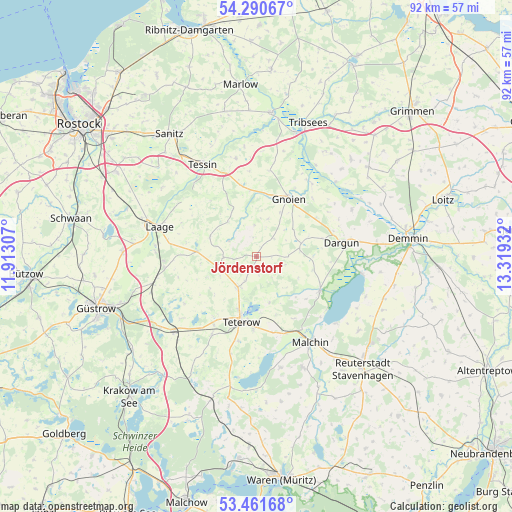
Jördenstorf GPS coordinates[2]
53° 52' 41.628" North, 12° 36' 58.284" East
| Map corner | latitude | longitude |
|---|---|---|
| Upper-left | 54.29067°, | 11.91307° |
| Center: | 53.87823°, | 12.61619° |
| Lower-right: | 53.46168°, | 13.31932° |
| Map W x H: | 92.2×92.2 km | = 57.3×57.3mi |
| max Lat: | 55.01917° ⇑9.1% North |
| Jördenstorf: | 53.87823° |
| min Lat: | ⇓90.9% South 47.40724° |
| min Long | Jördenstorf | max Long |
| 5.92978° | 12.61619° | 14.98853° |
| W 89%⇐ | ⇒11% E |
Elevation
Elevation of Jördenstorf is 50 m = 164 ft, and this is 199.1 m = 653 ft below average elevation for this country.
| Max E: |
1256 m = 4121 ft | 78.9% |
| Avg. | 249.1 m = 817 ft | |
| Jördenstorf | 50 m = 164 ft | |
Min E: |
-5 m = -16 ft | 21.1% |
See also: Germany elevation on elevation.city.
Geographical zone
Jördenstorf is located in North temperate zone (between Tropic of Cancer and the Arctic Circle). Distance of this North polar circle is 1410.5 km =876.4 mi to North.| Distance of | km | miles | from Jördenstorf |
|---|---|---|---|
| North Pole | 4016.4 | 2495.7 | to North |
| Arctic Circle | 1410.5 | 876.4 | to North |
| Tropic Cancer | 3384.8 | 2103.2 | to South |
| Equator | 5990.7 | 3722.4 | to South |


Nearby cities:
15 places around Jördenstorf: (largest is in red/bold)
• Altkalen
8.4 km =5.2 mi,  74°
74°
• Dargun
15.5 km =9.6 mi,  80°
80°
• Gnoien
11.8 km =7.3 mi,  31°
31°
• Groß Roge
13.3 km =8.3 mi,  213°
213°
• Groß Wüstenfelde
4.2 km =2.6 mi,  263°
263°
• Lelkendorf
8.6 km =5.3 mi,  117°
117°
• Neukalen
13 km =8.1 mi, 118°
• Pampow
13.7 km =8.5 mi,  182°
182°
• Remplin
14.8 km =9.2 mi,  158°
158°
• Selpin
14.8 km =9.2 mi,  327°
327°
• Stubbendorf
15.2 km =9.4 mi,  58°
58°
• Teterow
11.7 km =7.3 mi,  193°
193°
• Walkendorf
9.3 km =5.8 mi, 332°
• Wardow
14.8 km =9.2 mi,  293°
293°
• Warsow
13.3 km =8.3 mi,  105°
105°
Sources, notices
• [Note1] Compared only with cities in Germany existing in our database
• [Src1] Map data: © OpenStreetMap contributors (CC-BY-SA)
• [Src2] Other city data from geonames.org with taken over terms of usage.
• [Src3] Geographical zone / Annual Mean Temperature by Robert A. Rohde @ Wikipedia
