Walkendorf geodata
Walkendorf (Mecklenburg-Vorpommern) is a populated place; located in Germany in Europe/Berlin (GMT+2) time zone. With population of 520 people, there are 9251 cities with bigger population in this country. Compared to other cities in Germany, 92.1% of cities are located further ↓South; 88.4% of cities are located further ←West and 86.3% of cities have higher elevation than Walkendorf. Note1
Administrative division(s):
- Level 1: Mecklenburg-Vorpommern
- Level 3: Landkreis Rostock
- Level 4: Walkendorf


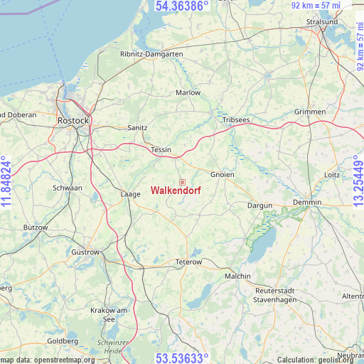
Walkendorf GPS coordinates[2]
53° 57' 7.74" North, 12° 33' 4.896" East
| Map corner | latitude | longitude |
|---|---|---|
| Upper-left | 54.36386°, | 11.84824° |
| Center: | 53.95215°, | 12.55136° |
| Lower-right: | 53.53633°, | 13.25449° |
| Map W x H: | 92×92 km | = 57.2×57.2mi |
| max Lat: | 55.01917° ⇑7.9% North |
| Walkendorf: | 53.95215° |
| min Lat: | ⇓92.1% South 47.40724° |
| min Long | Walkendorf | max Long |
| 5.92978° | 12.55136° | 14.98853° |
| W 88.4%⇐ | ⇒11.6% E |
Elevation
Elevation of Walkendorf is 32 m = 105 ft, and this is 217.1 m = 712 ft below average elevation for this country.
| Max E: |
1256 m = 4121 ft | 86.3% |
| Avg. | 249.1 m = 817 ft | |
| Walkendorf | 32 m = 105 ft | |
Min E: |
-5 m = -16 ft | 13.7% |
See also: Germany elevation on elevation.city.
Geographical zone
Walkendorf is located in North temperate zone (between Tropic of Cancer and the Arctic Circle). Distance of this North polar circle is 1402.3 km =871.3 mi to North.| Distance of | km | miles | from Walkendorf |
|---|---|---|---|
| North Pole | 4008.1 | 2490.5 | to North |
| Arctic Circle | 1402.3 | 871.3 | to North |
| Tropic Cancer | 3393 | 2108.3 | to South |
| Equator | 5998.9 | 3727.5 | to South |


Nearby cities:
15 places around Walkendorf: (largest is in red/bold)
• Altkalen
13.7 km =8.5 mi,  115°
115°
• Behren-Lübchin
11.3 km =7 mi,  40°
40°
• Cammin
13.3 km =8.3 mi,  288°
288°
• Diekhof
15.6 km =9.7 mi,  232°
232°
• Gnoien
10.6 km =6.6 mi,  80°
80°
• Groß Wüstenfelde
8.7 km =5.4 mi,  179°
179°
• Jördenstorf
9.3 km =5.8 mi,  152°
152°
• Laage
13.7 km =8.5 mi,  257°
257°
• Lelkendorf
17 km =10.6 mi,  135°
135°
• Lieblingshof
16.9 km =10.5 mi,  300°
300°
• Liessow
15.7 km =9.8 mi,  242°
242°
• Selpin
5.7 km =3.5 mi,  319°
319°
• Tessin
10.1 km =6.3 mi,  326°
326°
• Thelkow
9.4 km =5.8 mi,  3°
3°
• Wardow
9.7 km =6 mi, 255°
Sources, notices
• [Note1] Compared only with cities in Germany existing in our database
• [Src1] Map data: © OpenStreetMap contributors (CC-BY-SA)
• [Src2] Other city data from geonames.org with taken over terms of usage.
• [Src3] Geographical zone / Annual Mean Temperature by Robert A. Rohde @ Wikipedia
