Illmensee geodata
Illmensee (Baden-Württemberg) is a seat of a fourth-order administrative division; located in Germany in Europe/Berlin (GMT+2) time zone. With population of 2,030 people, there are 5026 cities with bigger population in this country. Compared to other cities in Germany, 97% of cities are located further ↑North; 59.7% of cities are located further →East and 97.6% of cities have lower elevation than Illmensee. Note1
Administrative division(s):
- Level 1: Baden-Württemberg
- Level 2: Tübingen Region
- Level 3: Landkreis Sigmaringen
- Level 4: Illmensee


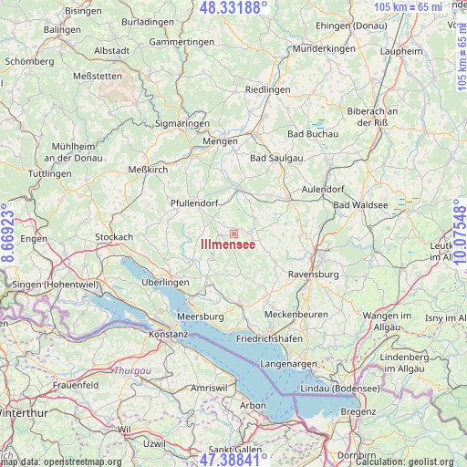
Illmensee GPS coordinates[2]
47° 51' 44.244" North, 9° 22' 20.46" East
| Map corner | latitude | longitude |
|---|---|---|
| Upper-left | 48.33188°, | 8.66923° |
| Center: | 47.86229°, | 9.37235° |
| Lower-right: | 47.38841°, | 10.07548° |
| Map W x H: | 104.9×104.9 km | = 65.2×65.2mi |
| max Lat: | 55.01917° ⇑97% North |
| Illmensee: | 47.86229° |
| min Lat: | ⇓3% South 47.40724° |
| min Long | Illmensee | max Long |
| 5.92978° | 9.37235° | 14.98853° |
| W 40.3%⇐ | ⇒59.7% E |
Elevation
Elevation of Illmensee is 691 m = 2267 ft, and this is 441.9 m = 1450 ft above average elevation for this country.
| Max E: |
1256 m = 4121 ft | 2.4% |
| Illmensee | 691 m 2267 ft | |
| Avg. | 249.1 m = 817 ft | |
Min E: |
-5 m = -16 ft | 97.6% |
See also: Germany elevation on elevation.city.
Geographical zone
Illmensee is located in North temperate zone (between Tropic of Cancer and the Arctic Circle). Distance of this North polar circle is 2079.4 km =1292.1 mi to North.| Distance of | km | miles | from Illmensee |
|---|---|---|---|
| North Pole | 4685.3 | 2911.3 | to North |
| Arctic Circle | 2079.4 | 1292.1 | to North |
| Tropic Cancer | 2715.9 | 1687.6 | to South |
| Equator | 5321.8 | 3306.8 | to South |


Nearby cities:
15 places around Illmensee: (largest is in red/bold)
• Ebenweiler
11.6 km =7.2 mi,  68°
68°
• Eichstegen
12.4 km =7.7 mi,  50°
50°
• Fleischwangen
8.6 km =5.3 mi, 74°
• Frickingen
9.1 km =5.7 mi,  234°
234°
• Guggenhausen
7.1 km =4.4 mi, 54°
• Heiligenberg
6.4 km =4 mi,  224°
224°
• Horgenzell
11.3 km =7 mi,  124°
124°
• Hoßkirch
11.3 km =7 mi,  30°
30°
• Königseggwald
8.6 km =5.3 mi,  22°
22°
• Ostrach
9.8 km =6.1 mi,  4°
4°
• Pfullendorf
11.1 km =6.9 mi,  309°
309°
• Riedhausen
6.7 km =4.2 mi,  38°
38°
• Salem
12.7 km =7.9 mi,  208°
208°
• Unterwaldhausen
8.2 km =5.1 mi,  59°
59°
• Wilhelmsdorf
4 km =2.5 mi,  83°
83°
Sources, notices
• [Note1] Compared only with cities in Germany existing in our database
• [Src1] Map data: © OpenStreetMap contributors (CC-BY-SA)
• [Src2] Other city data from geonames.org with taken over terms of usage.
• [Src3] Geographical zone / Annual Mean Temperature by Robert A. Rohde @ Wikipedia
