Fleischwangen geodata
Fleischwangen (Baden-Württemberg) is a seat of a fourth-order administrative division; located in Germany in Europe/Berlin (GMT+2) time zone. With population of 602 people, there are 8809 cities with bigger population in this country. Compared to other cities in Germany, 96.9% of cities are located further ↑North; 58% of cities are located further →East and 96.2% of cities have lower elevation than Fleischwangen. Note1
Administrative division(s):
- Level 1: Baden-Württemberg
- Level 2: Tübingen Region
- Level 3: Landkreis Ravensburg
- Level 4: Fleischwangen


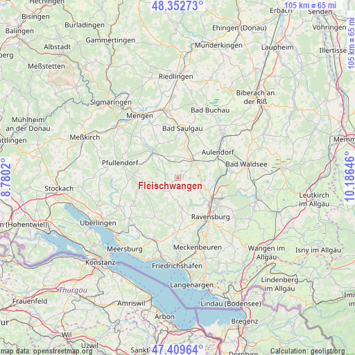
Fleischwangen GPS coordinates[2]
47° 52' 59.988" North, 9° 28' 59.988" East
| Map corner | latitude | longitude |
|---|---|---|
| Upper-left | 48.35273°, | 8.7802° |
| Center: | 47.88333°, | 9.48333° |
| Lower-right: | 47.40964°, | 10.18646° |
| Map W x H: | 104.9×104.9 km | = 65.2×65.2mi |
| max Lat: | 55.01917° ⇑96.9% North |
| Fleischwangen: | 47.88333° |
| min Lat: | ⇓3.1% South 47.40724° |
| min Long | Fleischwangen | max Long |
| 5.92978° | 9.48333° | 14.98853° |
| W 42%⇐ | ⇒58% E |
Elevation
Elevation of Fleischwangen is 634 m = 2080 ft, and this is 384.9 m = 1263 ft above average elevation for this country.
| Max E: |
1256 m = 4121 ft | 3.8% |
| Fleischwangen | 634 m 2080 ft | |
| Avg. | 249.1 m = 817 ft | |
Min E: |
-5 m = -16 ft | 96.2% |
See also: Germany elevation on elevation.city.
Geographical zone
Fleischwangen is located in North temperate zone (between Tropic of Cancer and the Arctic Circle). Distance of this North polar circle is 2077 km =1290.6 mi to North.| Distance of | km | miles | from Fleischwangen |
|---|---|---|---|
| North Pole | 4682.9 | 2909.8 | to North |
| Arctic Circle | 2077 | 1290.6 | to North |
| Tropic Cancer | 2718.2 | 1689 | to South |
| Equator | 5324.1 | 3308.2 | to South |


Nearby cities:
15 places around Fleischwangen: (largest is in red/bold)
• Altshausen
6.7 km =4.2 mi,  33°
33°
• Boms
10.6 km =6.6 mi,  13°
13°
• Ebenweiler
3.1 km =1.9 mi,  53°
53°
• Eichstegen
5.7 km =3.5 mi, 12°
• Fronreute
6.6 km =4.1 mi,  102°
102°
• Guggenhausen
3.1 km =1.9 mi,  306°
306°
• Horgenzell
8.7 km =5.4 mi,  173°
173°
• Hoßkirch
7.8 km =4.8 mi,  341°
341°
• Illmensee
8.6 km =5.3 mi,  254°
254°
• Königseggwald
7.5 km =4.7 mi,  318°
318°
• Ostrach
10.5 km =6.5 mi, 314°
• Riedhausen
5 km =3.1 mi, 305°
• Unterwaldhausen
2.2 km =1.4 mi,  326°
326°
• Wilhelmsdorf
4.7 km =2.9 mi, 245°
• Wolpertswende
9.7 km =6 mi,  82°
82°
Sources, notices
• [Note1] Compared only with cities in Germany existing in our database
• [Src1] Map data: © OpenStreetMap contributors (CC-BY-SA)
• [Src2] Other city data from geonames.org with taken over terms of usage.
• [Src3] Geographical zone / Annual Mean Temperature by Robert A. Rohde @ Wikipedia
