Horgenzell geodata
Horgenzell (Baden-Württemberg) is a seat of a fourth-order administrative division; located in Germany in Europe/Berlin (GMT+2) time zone. With population of 4,663 people, there are 2955 cities with bigger population in this country. Compared to other cities in Germany, 97.6% of cities are located further ↑North; 57.8% of cities are located further →East and 95.8% of cities have lower elevation than Horgenzell. Note1
Administrative division(s):
- Level 1: Baden-Württemberg
- Level 2: Tübingen Region
- Level 3: Landkreis Ravensburg
- Level 4: Horgenzell


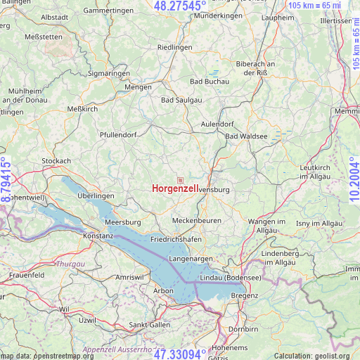
Horgenzell GPS coordinates[2]
47° 48' 19.224" North, 9° 29' 50.172" East
| Map corner | latitude | longitude |
|---|---|---|
| Upper-left | 48.27545°, | 8.79415° |
| Center: | 47.80534°, | 9.49727° |
| Lower-right: | 47.33094°, | 10.2004° |
| Map W x H: | 105×105 km | = 65.2×65.2mi |
| max Lat: | 55.01917° ⇑97.6% North |
| Horgenzell: | 47.80534° |
| min Lat: | ⇓2.4% South 47.40724° |
| min Long | Horgenzell | max Long |
| 5.92978° | 9.49727° | 14.98853° |
| W 42.2%⇐ | ⇒57.8% E |
Elevation
Elevation of Horgenzell is 619 m = 2031 ft, and this is 369.9 m = 1214 ft above average elevation for this country.
| Max E: |
1256 m = 4121 ft | 4.2% |
| Horgenzell | 619 m 2031 ft | |
| Avg. | 249.1 m = 817 ft | |
Min E: |
-5 m = -16 ft | 95.8% |
See also: Germany elevation on elevation.city.
Geographical zone
Horgenzell is located in North temperate zone (between Tropic of Cancer and the Arctic Circle). Distance of this North polar circle is 2085.7 km =1296 mi to North.| Distance of | km | miles | from Horgenzell |
|---|---|---|---|
| North Pole | 4691.6 | 2915.2 | to North |
| Arctic Circle | 2085.7 | 1296 | to North |
| Tropic Cancer | 2709.5 | 1683.6 | to South |
| Equator | 5315.5 | 3302.9 | to South |


Nearby cities:
15 places around Horgenzell: (largest is in red/bold)
• Baienfurt
11.8 km =7.3 mi,  77°
77°
• Berg
7.8 km =4.8 mi, 80°
• Ebenweiler
10.6 km =6.6 mi,  7°
7°
• Fleischwangen
8.7 km =5.4 mi,  353°
353°
• Fronreute
9 km =5.6 mi,  36°
36°
• Guggenhausen
11.1 km =6.9 mi,  341°
341°
• Illmensee
11.3 km =7 mi,  304°
304°
• Markdorf
12.5 km =7.8 mi,  219°
219°
• Meckenbeuren
12.8 km =8 mi,  156°
156°
• Oberteuringen
9.3 km =5.8 mi,  192°
192°
• Ravensburg
8.9 km =5.5 mi,  107°
107°
• Riedhausen
12.7 km =7.9 mi, 336°
• Unterwaldhausen
10.8 km =6.7 mi, 347°
• Weingarten
10.6 km =6.6 mi,  87°
87°
• Wilhelmsdorf
8.6 km =5.3 mi,  321°
321°
Sources, notices
• [Note1] Compared only with cities in Germany existing in our database
• [Src1] Map data: © OpenStreetMap contributors (CC-BY-SA)
• [Src2] Other city data from geonames.org with taken over terms of usage.
• [Src3] Geographical zone / Annual Mean Temperature by Robert A. Rohde @ Wikipedia
