Hürth geodata
Hürth (North Rhine-Westphalia) is a populated place; located in Germany in Europe/Berlin (GMT+2) time zone. With population of 54,678 people, there are 198 cities with bigger population in this country. Compared to other cities in Germany, 55.6% of cities are located further ↓South; 94.8% of cities are located further →East and 70% of cities have higher elevation than Hürth. Note1
Administrative division(s):
- Level 1: North Rhine-Westphalia
- Level 2: Regierungsbezirk Köln
- Level 3: Rhein-Erft-Kreis
- Level 4: Hürth


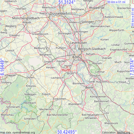
Hürth GPS coordinates[2]
50° 52' 14.844" North, 6° 52' 3.396" East
| Map corner | latitude | longitude |
|---|---|---|
| Upper-left | 51.3124°, | 6.16449° |
| Center: | 50.87079°, | 6.86761° |
| Lower-right: | 50.42495°, | 7.57074° |
| Map W x H: | 98.7×98.7 km | = 61.3×61.3mi |
| max Lat: | 55.01917° ⇑44.4% North |
| Hürth: | 50.87079° |
| min Lat: | ⇓55.6% South 47.40724° |
| min Long | Hürth | max Long |
| 5.92978° | 6.86761° | 14.98853° |
| W 5.2%⇐ | ⇒94.8% E |
Elevation
Elevation of Hürth is 91 m = 299 ft, and this is 158.1 m = 519 ft below average elevation for this country.
| Max E: |
1256 m = 4121 ft | 70% |
| Avg. | 249.1 m = 817 ft | |
| Hürth | 91 m = 299 ft | |
Min E: |
-5 m = -16 ft | 30% |
See also: Hürth elevation on elevation.city.
Geographical zone
Hürth is located in North temperate zone (between Tropic of Cancer and the Arctic Circle). Distance of this North polar circle is 1744.9 km =1084.2 mi to North.| Distance of | km | miles | from Hürth |
|---|---|---|---|
| North Pole | 4350.8 | 2703.5 | to North |
| Arctic Circle | 1744.9 | 1084.2 | to North |
| Tropic Cancer | 3050.4 | 1895.4 | to South |
| Equator | 5656.3 | 3514.7 | to South |


Nearby cities:
15 places around Hürth: (largest is in red/bold)
• Altstadt Nord
9.9 km =6.2 mi,  39°
39°
• Altstadt Sud
9.5 km =5.9 mi, 42°
• Bayenthal
8.4 km =5.2 mi,  56°
56°
• Brühl
5.3 km =3.3 mi,  150°
150°
• Deutz
10.3 km =6.4 mi,  46°
46°
• Erftstadt
8.1 km =5 mi,  219°
219°
• Frechen
6.3 km =3.9 mi,  321°
321°
• Humboldtkolonie
11.2 km =7 mi, 52°
• Köln
9 km =5.6 mi, 39°
• Neuehrenfeld
10.8 km =6.7 mi,  26°
26°
• Neustadt/Nord
10.4 km =6.5 mi, 32°
• Neustadt/Süd
8.2 km =5.1 mi, 42°
• Poll
9.8 km =6.1 mi, 61°
• Türnich
8 km =5 mi,  260°
260°
• Wesseling
9 km =5.6 mi,  122°
122°
Sources, notices
• [Note1] Compared only with cities in Germany existing in our database
• [Src1] Map data: © OpenStreetMap contributors (CC-BY-SA)
• [Src2] Other city data from geonames.org with taken over terms of usage.
• [Src3] Geographical zone / Annual Mean Temperature by Robert A. Rohde @ Wikipedia
