Altstadt Sud geodata
Altstadt Sud (North Rhine-Westphalia) is a section of populated place; located in Germany in Europe/Berlin (GMT+2) time zone. With population of 27,515 people, there are 520 cities with bigger population in this country. Compared to other cities in Germany, 56.8% of cities are located further ↓South; 93.8% of cities are located further →East and 78.3% of cities have higher elevation than Altstadt Sud. Note1
Administrative division(s):
- Level 1: North Rhine-Westphalia
- Level 2: Regierungsbezirk Köln
- Level 3: Kreisfreie Stadt Köln
- Level 4: Köln


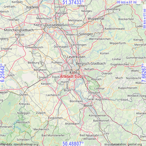
Altstadt Sud GPS coordinates[2]
50° 55' 59.916" North, 6° 57' 34.344" East
| Map corner | latitude | longitude |
|---|---|---|
| Upper-left | 51.37433°, | 6.25642° |
| Center: | 50.93331°, | 6.95954° |
| Lower-right: | 50.48807°, | 7.66267° |
| Map W x H: | 98.5×98.5 km | = 61.2×61.2mi |
| max Lat: | 55.01917° ⇑43.2% North |
| Altstadt Sud: | 50.93331° |
| min Lat: | ⇓56.8% South 47.40724° |
| min Long | Altstadt Sud | max Long |
| 5.92978° | 6.95954° | 14.98853° |
| W 6.2%⇐ | ⇒93.8% E |
Elevation
Elevation of Altstadt Sud is 52 m = 171 ft, and this is 197.1 m = 647 ft below average elevation for this country.
| Max E: |
1256 m = 4121 ft | 78.3% |
| Avg. | 249.1 m = 817 ft | |
| Altstadt Sud | 52 m = 171 ft | |
Min E: |
-5 m = -16 ft | 21.7% |
See also: Germany elevation on elevation.city.
Geographical zone
Altstadt Sud is located in North temperate zone (between Tropic of Cancer and the Arctic Circle). Distance of this North polar circle is 1737.9 km =1079.9 mi to North.| Distance of | km | miles | from Altstadt Sud |
|---|---|---|---|
| North Pole | 4343.8 | 2699.1 | to North |
| Arctic Circle | 1737.9 | 1079.9 | to North |
| Tropic Cancer | 3057.3 | 1899.7 | to South |
| Equator | 5663.3 | 3519 | to South |


Nearby cities:
15 places around Altstadt Sud: (largest is in red/bold)
• Altstadt Nord
0.6 km =0.4 mi,  347°
347°
• Bayenthal
2.4 km =1.5 mi,  165°
165°
• Bilderstoeckchen
4.6 km =2.9 mi,  332°
332°
• Buchforst
3.8 km =2.4 mi,  58°
58°
• Deutz
1.1 km =0.7 mi,  82°
82°
• Humboldtkolonie
2.5 km =1.6 mi,  93°
93°
• Kalk
3.3 km =2.1 mi, 76°
• Köln
0.7 km =0.4 mi,  270°
270°
• Mülheim
4.8 km =3 mi,  40°
40°
• Neuehrenfeld
3.2 km =2 mi, 328°
• Neustadt/Nord
1.9 km =1.2 mi, 334°
• Neustadt/Süd
1.2 km =0.7 mi,  222°
222°
• Nippes
3.6 km =2.2 mi, 352°
• Poll
3.2 km =2 mi,  136°
136°
• Riehl
3.9 km =2.4 mi,  16°
16°
Sources, notices
• [Note1] Compared only with cities in Germany existing in our database
• [Src1] Map data: © OpenStreetMap contributors (CC-BY-SA)
• [Src2] Other city data from geonames.org with taken over terms of usage.
• [Src3] Geographical zone / Annual Mean Temperature by Robert A. Rohde @ Wikipedia
