Hüblingen geodata
Hüblingen (Rheinland-Pfalz) is a seat of a fourth-order administrative division; located in Germany in Europe/Berlin (GMT+2) time zone. With population of 328 people, there are 9956 cities with bigger population in this country. Compared to other cities in Germany, 51.3% of cities are located further ↑North; 75.7% of cities are located further →East and 73.6% of cities have lower elevation than Hüblingen. Note1


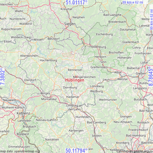
Hüblingen GPS coordinates[2]
50° 34' 0.012" North, 8° 4' 59.988" East
| Map corner | latitude | longitude |
|---|---|---|
| Upper-left | 51.01117°, | 7.3802° |
| Center: | 50.56667°, | 8.08333° |
| Lower-right: | 50.11794°, | 8.78645° |
| Map W x H: | 99.3×99.3 km | = 61.7×61.7mi |
| max Lat: | 55.01917° ⇑51.3% North |
| Hüblingen: | 50.56667° |
| min Lat: | ⇓48.7% South 47.40724° |
| min Long | Hüblingen | max Long |
| 5.92978° | 8.08333° | 14.98853° |
| W 24.3%⇐ | ⇒75.7% E |
Elevation
Elevation of Hüblingen is 387 m = 1270 ft, and this is 137.9 m = 452 ft above average elevation for this country.
| Max E: |
1256 m = 4121 ft | 26.4% |
| Hüblingen | 387 m 1270 ft | |
| Avg. | 249.1 m = 817 ft | |
Min E: |
-5 m = -16 ft | 73.6% |
See also: Germany elevation on elevation.city.
Geographical zone
Hüblingen is located in North temperate zone (between Tropic of Cancer and the Arctic Circle). Distance of this North polar circle is 1778.7 km =1105.2 mi to North.| Distance of | km | miles | from Hüblingen |
|---|---|---|---|
| North Pole | 4384.6 | 2724.5 | to North |
| Arctic Circle | 1778.7 | 1105.2 | to North |
| Tropic Cancer | 3016.6 | 1874.4 | to South |
| Equator | 5622.5 | 3493.7 | to South |


Nearby cities:
15 places around Hüblingen: (largest is in red/bold)
• Berzhahn
6.2 km =3.9 mi,  241°
241°
• Elsoff
2.5 km =1.6 mi,  66°
66°
• Gemünden
4.8 km =3 mi,  259°
259°
• Hellenhahn-Schellenberg
6.5 km =4 mi,  321°
321°
• Irmtraut
2.2 km =1.4 mi,  212°
212°
• Mengerskirchen
5.1 km =3.2 mi,  93°
93°
• Neunkirchen
2.6 km =1.6 mi,  146°
146°
• Oberrod
3.7 km =2.3 mi,  56°
56°
• Pottum
7 km =4.3 mi,  302°
302°
• Rennerod
4.8 km =3 mi,  345°
345°
• Seck
2.6 km =1.6 mi, 296°
• Waldbrunn
5.6 km =3.5 mi,  161°
161°
• Waldmühlen
2.2 km =1.4 mi,  327°
327°
• Westernohe
2.8 km =1.7 mi,  25°
25°
• Winnen
5.1 km =3.2 mi,  278°
278°
Sources, notices
• [Note1] Compared only with cities in Germany existing in our database
• [Src1] Map data: © OpenStreetMap contributors (CC-BY-SA)
• [Src2] Other city data from geonames.org with taken over terms of usage.
• [Src3] Geographical zone / Annual Mean Temperature by Robert A. Rohde @ Wikipedia
