Elsoff geodata
Elsoff (Rheinland-Pfalz) is a populated place; located in Germany in Europe/Berlin (GMT+2) time zone. With population of 996 people, there are 7198 cities with bigger population in this country. Compared to other cities in Germany, 51.2% of cities are located further ↑North; 75.2% of cities are located further →East and 72.5% of cities have lower elevation than Elsoff. Note1
Administrative division(s):
- Level 1: Rheinland-Pfalz
- Level 3: Westerwaldkreis
- Level 4: Elsoff (Westerwald)


Elsoff GPS coordinates[2]
50° 34' 32.988" North, 8° 6' 57.996" East
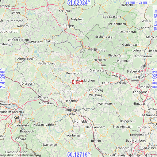
| Map corner | latitude | longitude |
|---|---|---|
| Upper-left | 51.02024°, | 7.41298° |
| Center: | 50.57583°, | 8.11611° |
| Lower-right: | 50.12719°, | 8.81923° |
| Map W x H: | 99.3×99.3 km | = 61.7×61.7mi |
| max Lat: | 55.01917° ⇑51.2% North |
| Elsoff: | 50.57583° |
| min Lat: | ⇓48.8% South 47.40724° |
| min Long | Elsoff | max Long |
| 5.92978° | 8.11611° | 14.98853° |
| W 24.8%⇐ | ⇒75.2% E |
Elevation
Elevation of Elsoff is 378 m = 1240 ft, and this is 128.9 m = 423 ft above average elevation for this country.
| Max E: |
1256 m = 4121 ft | 27.5% |
| Elsoff | 378 m 1240 ft | |
| Avg. | 249.1 m = 817 ft | |
Min E: |
-5 m = -16 ft | 72.5% |
See also: Germany elevation on elevation.city.
Geographical zone
Elsoff is located in North temperate zone (between Tropic of Cancer and the Arctic Circle). Distance of this North polar circle is 1777.7 km =1104.6 mi to North.| Distance of | km | miles | from Elsoff |
|---|---|---|---|
| North Pole | 4383.6 | 2723.8 | to North |
| Arctic Circle | 1777.7 | 1104.6 | to North |
| Tropic Cancer | 3017.6 | 1875 | to South |
| Equator | 5623.5 | 3494.3 | to South |


Nearby cities:
15 places around Elsoff: (largest is in red/bold)
• Gemünden
7.3 km =4.5 mi,  254°
254°
• Hellenhahn-Schellenberg
7.5 km =4.7 mi,  302°
302°
• Homberg
7.4 km =4.6 mi,  354°
354°
• Hüblingen
2.5 km =1.6 mi, 246°
• Irmtraut
4.5 km =2.8 mi,  230°
230°
• Mengerskirchen
3.1 km =1.9 mi,  115°
115°
• Neunkirchen
3.3 km =2.1 mi,  195°
195°
• Oberrod
1.3 km =0.8 mi,  37°
37°
• Rehe
6.4 km =4 mi,  0°
0°
• Rennerod
5 km =3.1 mi,  316°
316°
• Seck
4.7 km =2.9 mi,  271°
271°
• Waldbrunn
6.4 km =4 mi,  185°
185°
• Waldmühlen
3.6 km =2.2 mi,  283°
283°
• Westernohe
1.9 km =1.2 mi, 323°
• Winnen
7.4 km =4.6 mi, 267°
Sources, notices
• [Note1] Compared only with cities in Germany existing in our database
• [Src1] Map data: © OpenStreetMap contributors (CC-BY-SA)
• [Src2] Other city data from geonames.org with taken over terms of usage.
• [Src3] Geographical zone / Annual Mean Temperature by Robert A. Rohde @ Wikipedia
