Hohenwestedt geodata
Hohenwestedt (Schleswig-Holstein) is a seat of a fourth-order administrative division; located in Germany in Europe/Berlin (GMT+2) time zone. With population of 5,092 people, there are 2794 cities with bigger population in this country. Compared to other cities in Germany, 93.8% of cities are located further ↓South; 55.1% of cities are located further →East and 75.5% of cities have higher elevation than Hohenwestedt. Note1
Administrative division(s):
- Level 1: Schleswig-Holstein
- Level 3: Kreis Rendsburg-Eckernförde
- Level 4: Hohenwestedt


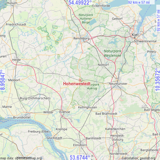
Hohenwestedt GPS coordinates[2]
54° 5' 19.896" North, 9° 39' 12.924" East
| Map corner | latitude | longitude |
|---|---|---|
| Upper-left | 54.49922°, | 8.95047° |
| Center: | 54.08886°, | 9.65359° |
| Lower-right: | 53.6744°, | 10.35672° |
| Map W x H: | 91.7×91.7 km | = 57×57mi |
| max Lat: | 55.01917° ⇑6.2% North |
| Hohenwestedt: | 54.08886° |
| min Lat: | ⇓93.8% South 47.40724° |
| min Long | Hohenwestedt | max Long |
| 5.92978° | 9.65359° | 14.98853° |
| W 44.9%⇐ | ⇒55.1% E |
Elevation
Elevation of Hohenwestedt is 61 m = 200 ft, and this is 188.1 m = 617 ft below average elevation for this country.
| Max E: |
1256 m = 4121 ft | 75.5% |
| Avg. | 249.1 m = 817 ft | |
| Hohenwestedt | 61 m = 200 ft | |
Min E: |
-5 m = -16 ft | 24.5% |
See also: Germany elevation on elevation.city.
Geographical zone
Hohenwestedt is located in North temperate zone (between Tropic of Cancer and the Arctic Circle). Distance of this North polar circle is 1387.1 km =861.9 mi to North.| Distance of | km | miles | from Hohenwestedt |
|---|---|---|---|
| North Pole | 3992.9 | 2481.1 | to North |
| Arctic Circle | 1387.1 | 861.9 | to North |
| Tropic Cancer | 3408.2 | 2117.8 | to South |
| Equator | 6014.1 | 3737 | to South |


Nearby cities:
15 places around Hohenwestedt: (largest is in red/bold)
• Dörpstedt
5.9 km =3.7 mi,  315°
315°
• Grauel
2.6 km =1.6 mi,  160°
160°
• Hennstedt
7.4 km =4.6 mi,  146°
146°
• Jahrsdorf
2.8 km =1.7 mi,  208°
208°
• Meezen
5.3 km =3.3 mi,  144°
144°
• Mörel
6 km =3.7 mi,  59°
59°
• Nienborstel
5.5 km =3.4 mi,  334°
334°
• Nindorf
5.8 km =3.6 mi,  31°
31°
• Osterstedt
5.6 km =3.5 mi,  292°
292°
• Poyenberg
6.9 km =4.3 mi, 153°
• Reher
5.2 km =3.2 mi,  241°
241°
• Remmels
3.1 km =1.9 mi,  355°
355°
• Silzen
6.6 km =4.1 mi,  201°
201°
• Tappendorf
3.1 km =1.9 mi, 56°
• Wapelfeld
3.5 km =2.2 mi,  260°
260°
Sources, notices
• [Note1] Compared only with cities in Germany existing in our database
• [Src1] Map data: © OpenStreetMap contributors (CC-BY-SA)
• [Src2] Other city data from geonames.org with taken over terms of usage.
• [Src3] Geographical zone / Annual Mean Temperature by Robert A. Rohde @ Wikipedia
