Hohenstadt geodata
Hohenstadt (Baden-Württemberg) is a seat of a fourth-order administrative division; located in Germany in Europe/Berlin (GMT+2) time zone. With population of 745 people, there are 8126 cities with bigger population in this country. Compared to other cities in Germany, 88.6% of cities are located further ↑North; 55% of cities are located further →East and 99.3% of cities have lower elevation than Hohenstadt. Note1
Administrative division(s):
- Level 1: Baden-Württemberg
- Level 2: Regierungsbezirk Stuttgart
- Level 3: Landkreis Göppingen
- Level 4: Hohenstadt


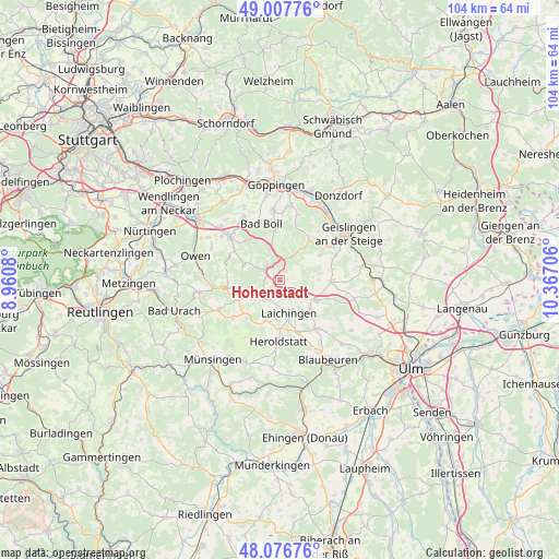
Hohenstadt GPS coordinates[2]
48° 32' 39.84" North, 9° 39' 50.148" East
| Map corner | latitude | longitude |
|---|---|---|
| Upper-left | 49.00776°, | 8.9608° |
| Center: | 48.5444°, | 9.66393° |
| Lower-right: | 48.07676°, | 10.36706° |
| Map W x H: | 103.5×103.5 km | = 64.3×64.3mi |
| max Lat: | 55.01917° ⇑88.6% North |
| Hohenstadt: | 48.5444° |
| min Lat: | ⇓11.4% South 47.40724° |
| min Long | Hohenstadt | max Long |
| 5.92978° | 9.66393° | 14.98853° |
| W 45%⇐ | ⇒55% E |
Elevation
Elevation of Hohenstadt is 814 m = 2671 ft, and this is 564.9 m = 1853 ft above average elevation for this country.
| Max E: |
1256 m = 4121 ft | 0.7% |
| Hohenstadt | 814 m 2671 ft | |
| Avg. | 249.1 m = 817 ft | |
Min E: |
-5 m = -16 ft | 99.3% |
See also: Germany elevation on elevation.city.
Geographical zone
Hohenstadt is located in North temperate zone (between Tropic of Cancer and the Arctic Circle). Distance of this North polar circle is 2003.5 km =1244.9 mi to North.| Distance of | km | miles | from Hohenstadt |
|---|---|---|---|
| North Pole | 4609.4 | 2864.1 | to North |
| Arctic Circle | 2003.5 | 1244.9 | to North |
| Tropic Cancer | 2791.7 | 1734.7 | to South |
| Equator | 5397.6 | 3353.9 | to South |


Nearby cities:
15 places around Hohenstadt: (largest is in red/bold)
• Bad Ditzenbach
5.7 km =3.5 mi,  31°
31°
• Bad Überkingen
11.5 km =7.1 mi,  57°
57°
• Berghülen
11.5 km =7.1 mi,  141°
141°
• Boll
11.6 km =7.2 mi,  341°
341°
• Deggingen
7.1 km =4.4 mi, 34°
• Dürnau
10.9 km =6.8 mi,  348°
348°
• Gammelshausen
10.7 km =6.6 mi, 354°
• Gruibingen
5.8 km =3.6 mi, 345°
• Laichingen
6.3 km =3.9 mi,  165°
165°
• Merklingen
7.6 km =4.7 mi,  118°
118°
• Mühlhausen
3.6 km =2.2 mi, 352°
• Neidlingen
8.2 km =5.1 mi,  297°
297°
• Nellingen
9.3 km =5.8 mi,  91°
91°
• Westerheim
4.4 km =2.7 mi,  221°
221°
• Wiesensteig
3.4 km =2.1 mi, 303°
Sources, notices
• [Note1] Compared only with cities in Germany existing in our database
• [Src1] Map data: © OpenStreetMap contributors (CC-BY-SA)
• [Src2] Other city data from geonames.org with taken over terms of usage.
• [Src3] Geographical zone / Annual Mean Temperature by Robert A. Rohde @ Wikipedia
