Westerheim geodata
Westerheim (Baden-Württemberg) is a seat of a fourth-order administrative division; located in Germany in Europe/Berlin (GMT+2) time zone. With population of 2,888 people, there are 4109 cities with bigger population in this country. Compared to other cities in Germany, 89% of cities are located further ↑North; 55.7% of cities are located further →East and 99.3% of cities have lower elevation than Westerheim. Note1
Administrative division(s):
- Level 1: Baden-Württemberg
- Level 2: Tübingen Region
- Level 3: Alb-Donau-Kreis
- Level 4: Westerheim


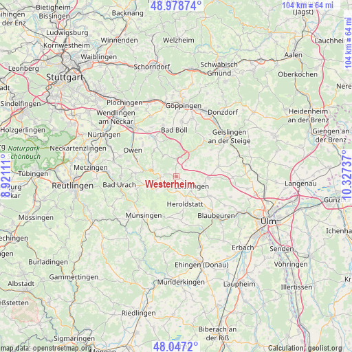
Westerheim GPS coordinates[2]
48° 30' 54.396" North, 9° 37' 27.264" East
| Map corner | latitude | longitude |
|---|---|---|
| Upper-left | 48.97874°, | 8.92111° |
| Center: | 48.51511°, | 9.62424° |
| Lower-right: | 48.0472°, | 10.32737° |
| Map W x H: | 103.6×103.6 km | = 64.4×64.4mi |
| max Lat: | 55.01917° ⇑89% North |
| Westerheim: | 48.51511° |
| min Lat: | ⇓11% South 47.40724° |
| min Long | Westerheim | max Long |
| 5.92978° | 9.62424° | 14.98853° |
| W 44.3%⇐ | ⇒55.7% E |
Elevation
Elevation of Westerheim is 816 m = 2677 ft, and this is 566.9 m = 1860 ft above average elevation for this country.
| Max E: |
1256 m = 4121 ft | 0.7% |
| Westerheim | 816 m 2677 ft | |
| Avg. | 249.1 m = 817 ft | |
Min E: |
-5 m = -16 ft | 99.3% |
See also: Germany elevation on elevation.city.
Geographical zone
Westerheim is located in North temperate zone (between Tropic of Cancer and the Arctic Circle). Distance of this North polar circle is 2006.8 km =1247 mi to North.| Distance of | km | miles | from Westerheim |
|---|---|---|---|
| North Pole | 4612.7 | 2866.2 | to North |
| Arctic Circle | 2006.8 | 1247 | to North |
| Tropic Cancer | 2788.5 | 1732.7 | to South |
| Equator | 5394.4 | 3351.9 | to South |


Nearby cities:
15 places around Westerheim: (largest is in red/bold)
• Altes Lager
12.6 km =7.8 mi,  210°
210°
• Bad Ditzenbach
10 km =6.2 mi,  35°
35°
• Berghülen
11.6 km =7.2 mi,  119°
119°
• Deggingen
11.5 km =7.1 mi, 37°
• Grabenstetten
12 km =7.5 mi,  274°
274°
• Gruibingen
9 km =5.6 mi,  9°
9°
• Hohenstadt
4.4 km =2.7 mi, 41°
• Laichingen
5.4 km =3.4 mi, 122°
• Lenningen
11.6 km =7.2 mi,  289°
289°
• Merklingen
9.6 km =6 mi,  92°
92°
• Mühlhausen
7.3 km =4.5 mi,  19°
19°
• Neidlingen
8.3 km =5.2 mi,  328°
328°
• Nellingen
12.6 km =7.8 mi,  76°
76°
• Weilheim an der Teck
12.9 km =8 mi, 330°
• Wiesensteig
5.1 km =3.2 mi,  0°
0°
Sources, notices
• [Note1] Compared only with cities in Germany existing in our database
• [Src1] Map data: © OpenStreetMap contributors (CC-BY-SA)
• [Src2] Other city data from geonames.org with taken over terms of usage.
• [Src3] Geographical zone / Annual Mean Temperature by Robert A. Rohde @ Wikipedia
