Hinterschmiding geodata
Hinterschmiding (Bavaria) is a seat of a fourth-order administrative division; located in Germany in Europe/Berlin (GMT+2) time zone. With population of 2,578 people, there are 4356 cities with bigger population in this country. Compared to other cities in Germany, 85% of cities are located further ↑North; 96.4% of cities are located further ←West and 98.7% of cities have lower elevation than Hinterschmiding. Note1
Administrative division(s):
- Level 1: Bavaria
- Level 2: Lower Bavaria
- Level 3: Landkreis Freyung-Grafenau
- Level 4: Hinterschmiding


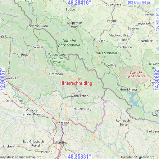
Hinterschmiding GPS coordinates[2]
48° 49' 24.132" North, 13° 36' 13.284" East
| Map corner | latitude | longitude |
|---|---|---|
| Upper-left | 49.28416°, | 12.90057° |
| Center: | 48.82337°, | 13.60369° |
| Lower-right: | 48.35831°, | 14.30682° |
| Map W x H: | 102.9×102.9 km | = 63.9×63.9mi |
| max Lat: | 55.01917° ⇑85% North |
| Hinterschmiding: | 48.82337° |
| min Lat: | ⇓15% South 47.40724° |
| min Long | Hinterschmiding | max Long |
| 5.92978° | 13.60369° | 14.98853° |
| W 96.4%⇐ | ⇒3.6% E |
Elevation
Elevation of Hinterschmiding is 746 m = 2448 ft, and this is 496.9 m = 1630 ft above average elevation for this country.
| Max E: |
1256 m = 4121 ft | 1.3% |
| Hinterschmiding | 746 m 2448 ft | |
| Avg. | 249.1 m = 817 ft | |
Min E: |
-5 m = -16 ft | 98.7% |
See also: Germany elevation on elevation.city.
Geographical zone
Hinterschmiding is located in North temperate zone (between Tropic of Cancer and the Arctic Circle). Distance of this North polar circle is 1972.5 km =1225.7 mi to North.| Distance of | km | miles | from Hinterschmiding |
|---|---|---|---|
| North Pole | 4578.4 | 2844.9 | to North |
| Arctic Circle | 1972.5 | 1225.7 | to North |
| Tropic Cancer | 2822.7 | 1753.9 | to South |
| Equator | 5428.6 | 3373.2 | to South |


Nearby cities:
15 places around Hinterschmiding: (largest is in red/bold)
• Freyung
4.4 km =2.7 mi,  249°
249°
• Fürsteneck
15.5 km =9.6 mi,  220°
220°
• Grafenau
15.6 km =9.7 mi,  284°
284°
• Grainet
4.3 km =2.7 mi,  127°
127°
• Haidmühle
12.7 km =7.9 mi,  88°
88°
• Hohenau
8.9 km =5.5 mi,  289°
289°
• Jandelsbrunn
12.2 km =7.6 mi,  144°
144°
• Mauth
7.5 km =4.7 mi,  349°
349°
• Neureichenau
13.4 km =8.3 mi, 128°
• Neuschönau
11.5 km =7.1 mi,  305°
305°
• Perlesreut
13 km =8.1 mi, 249°
• Philippsreut
7.6 km =4.7 mi,  50°
50°
• Ringelai
9.8 km =6.1 mi,  263°
263°
• Röhrnbach
11.1 km =6.9 mi,  212°
212°
• Waldkirchen
10.1 km =6.3 mi,  181°
181°
Sources, notices
• [Note1] Compared only with cities in Germany existing in our database
• [Src1] Map data: © OpenStreetMap contributors (CC-BY-SA)
• [Src2] Other city data from geonames.org with taken over terms of usage.
• [Src3] Geographical zone / Annual Mean Temperature by Robert A. Rohde @ Wikipedia
