Hilkenbrook geodata
Hilkenbrook (Lower Saxony) is a seat of a fourth-order administrative division; located in Germany in Europe/Berlin (GMT+2) time zone. With population of 805 people, there are 7875 cities with bigger population in this country. Compared to other cities in Germany, 81.6% of cities are located further ↓South; 83.1% of cities are located further →East and 95.6% of cities have higher elevation than Hilkenbrook. Note1


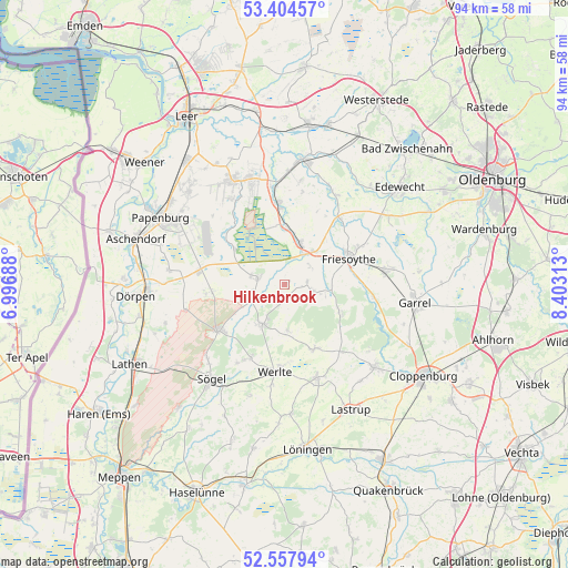
Hilkenbrook GPS coordinates[2]
52° 58' 59.988" North, 7° 42' 0" East
| Map corner | latitude | longitude |
|---|---|---|
| Upper-left | 53.40457°, | 6.99688° |
| Center: | 52.98333°, | 7.7° |
| Lower-right: | 52.55794°, | 8.40313° |
| Map W x H: | 94.1×94.1 km | = 58.5×58.5mi |
| max Lat: | 55.01917° ⇑18.4% North |
| Hilkenbrook: | 52.98333° |
| min Lat: | ⇓81.6% South 47.40724° |
| min Long | Hilkenbrook | max Long |
| 5.92978° | 7.7° | 14.98853° |
| W 16.9%⇐ | ⇒83.1% E |
Elevation
Elevation of Hilkenbrook is 7 m = 23 ft, and this is 242.1 m = 794 ft below average elevation for this country.
| Max E: |
1256 m = 4121 ft | 95.6% |
| Avg. | 249.1 m = 817 ft | |
| Hilkenbrook | 7 m = 23 ft | |
Min E: |
-5 m = -16 ft | 4.4% |
See also: Germany elevation on elevation.city.
Geographical zone
Hilkenbrook is located in North temperate zone (between Tropic of Cancer and the Arctic Circle). Distance of this North polar circle is 1510 km =938.3 mi to North.| Distance of | km | miles | from Hilkenbrook |
|---|---|---|---|
| North Pole | 4115.9 | 2557.5 | to North |
| Arctic Circle | 1510 | 938.3 | to North |
| Tropic Cancer | 3285.3 | 2041.4 | to South |
| Equator | 5891.2 | 3660.6 | to South |


Nearby cities:
15 places around Hilkenbrook: (largest is in red/bold)
• Bockhorst
10 km =6.2 mi,  303°
303°
• Breddenberg
6.7 km =4.2 mi,  241°
241°
• Börger
13.6 km =8.5 mi,  234°
234°
• Bösel
16.8 km =10.4 mi,  83°
83°
• Esterwegen
4.6 km =2.9 mi,  283°
283°
• Friesoythe
11.4 km =7.1 mi,  67°
67°
• Lorup
7.5 km =4.7 mi,  210°
210°
• Neubörger
17.1 km =10.6 mi,  260°
260°
• Ostrhauderfehn
17.6 km =10.9 mi,  341°
341°
• Rastdorf
7.8 km =4.8 mi,  175°
175°
• Surwold
12.4 km =7.7 mi,  267°
267°
• Sögel
19.3 km =12 mi,  219°
219°
• Vrees
12 km =7.5 mi,  158°
158°
• Werlte
14.9 km =9.3 mi, 184°
• Werpeloh
17.8 km =11.1 mi, 226°
Sources, notices
• [Note1] Compared only with cities in Germany existing in our database
• [Src1] Map data: © OpenStreetMap contributors (CC-BY-SA)
• [Src2] Other city data from geonames.org with taken over terms of usage.
• [Src3] Geographical zone / Annual Mean Temperature by Robert A. Rohde @ Wikipedia
