Esterwegen geodata
Esterwegen (Lower Saxony) is a seat of a fourth-order administrative division; located in Germany in Europe/Berlin (GMT+2) time zone. With population of 5,208 people, there are 2734 cities with bigger population in this country. Compared to other cities in Germany, 81.7% of cities are located further ↓South; 84.4% of cities are located further →East and 92% of cities have higher elevation than Esterwegen. Note1


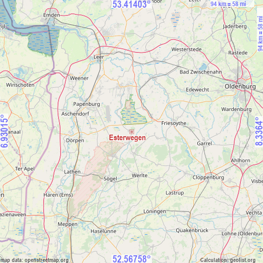
Esterwegen GPS coordinates[2]
52° 59' 34.368" North, 7° 37' 59.772" East
| Map corner | latitude | longitude |
|---|---|---|
| Upper-left | 53.41403°, | 6.93015° |
| Center: | 52.99288°, | 7.63327° |
| Lower-right: | 52.56758°, | 8.3364° |
| Map W x H: | 94.1×94.1 km | = 58.5×58.5mi |
| max Lat: | 55.01917° ⇑18.3% North |
| Esterwegen: | 52.99288° |
| min Lat: | ⇓81.7% South 47.40724° |
| min Long | Esterwegen | max Long |
| 5.92978° | 7.63327° | 14.98853° |
| W 15.6%⇐ | ⇒84.4% E |
Elevation
Elevation of Esterwegen is 16 m = 52 ft, and this is 233.1 m = 765 ft below average elevation for this country.
| Max E: |
1256 m = 4121 ft | 92% |
| Avg. | 249.1 m = 817 ft | |
| Esterwegen | 16 m = 52 ft | |
Min E: |
-5 m = -16 ft | 8% |
See also: Germany elevation on elevation.city.
Geographical zone
Esterwegen is located in North temperate zone (between Tropic of Cancer and the Arctic Circle). Distance of this North polar circle is 1508.9 km =937.6 mi to North.| Distance of | km | miles | from Esterwegen |
|---|---|---|---|
| North Pole | 4114.8 | 2556.8 | to North |
| Arctic Circle | 1508.9 | 937.6 | to North |
| Tropic Cancer | 3286.3 | 2042 | to South |
| Equator | 5892.3 | 3661.3 | to South |


Nearby cities:
15 places around Esterwegen: (largest is in red/bold)
• Bockhorst
5.9 km =3.7 mi,  319°
319°
• Breddenberg
4.5 km =2.8 mi,  199°
199°
• Börger
11.1 km =6.9 mi,  216°
216°
• Friesoythe
15.4 km =9.6 mi,  77°
77°
• Hilkenbrook
4.6 km =2.9 mi,  103°
103°
• Lorup
7.6 km =4.7 mi,  174°
174°
• Neubörger
13 km =8.1 mi,  252°
252°
• Neulehe
14.7 km =9.1 mi,  275°
275°
• Ostrhauderfehn
15.7 km =9.8 mi,  355°
355°
• Rastdorf
10.2 km =6.3 mi,  150°
150°
• Surwold
8.1 km =5 mi,  258°
258°
• Vrees
15.1 km =9.4 mi,  143°
143°
• Werlte
16.2 km =10.1 mi, 168°
• Werpeloh
15.8 km =9.8 mi,  211°
211°
• Wippingen
17 km =10.6 mi,  242°
242°
Sources, notices
• [Note1] Compared only with cities in Germany existing in our database
• [Src1] Map data: © OpenStreetMap contributors (CC-BY-SA)
• [Src2] Other city data from geonames.org with taken over terms of usage.
• [Src3] Geographical zone / Annual Mean Temperature by Robert A. Rohde @ Wikipedia
