Hettstadt geodata
Hettstadt (Bavaria) is a seat of a fourth-order administrative division; located in Germany in Europe/Berlin (GMT+2) time zone. With population of 3,780 people, there are 3418 cities with bigger population in this country. Compared to other cities in Germany, 69.1% of cities are located further ↑North; 52.6% of cities are located further →East and 59.3% of cities have lower elevation than Hettstadt. Note1
Administrative division(s):
- Level 1: Bavaria
- Level 2: Regierungsbezirk Unterfranken
- Level 3: Landkreis Würzburg
- Level 4: Hettstadt


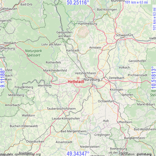
Hettstadt GPS coordinates[2]
49° 47' 57.984" North, 9° 48' 54" East
| Map corner | latitude | longitude |
|---|---|---|
| Upper-left | 50.25116°, | 9.11188° |
| Center: | 49.79944°, | 9.815° |
| Lower-right: | 49.34347°, | 10.51813° |
| Map W x H: | 100.9×100.9 km | = 62.7×62.7mi |
| max Lat: | 55.01917° ⇑69.1% North |
| Hettstadt: | 49.79944° |
| min Lat: | ⇓30.9% South 47.40724° |
| min Long | Hettstadt | max Long |
| 5.92978° | 9.815° | 14.98853° |
| W 47.4%⇐ | ⇒52.6% E |
Elevation
Elevation of Hettstadt is 285 m = 935 ft, and this is 35.9 m = 118 ft above average elevation for this country.
| Max E: |
1256 m = 4121 ft | 40.7% |
| Hettstadt | 285 m 935 ft | |
| Avg. | 249.1 m = 817 ft | |
Min E: |
-5 m = -16 ft | 59.3% |
See also: Germany elevation on elevation.city.
Geographical zone
Hettstadt is located in North temperate zone (between Tropic of Cancer and the Arctic Circle). Distance of this North polar circle is 1864 km =1158.2 mi to North.| Distance of | km | miles | from Hettstadt |
|---|---|---|---|
| North Pole | 4469.9 | 2777.5 | to North |
| Arctic Circle | 1864 | 1158.2 | to North |
| Tropic Cancer | 2931.3 | 1821.4 | to South |
| Equator | 5537.2 | 3440.7 | to South |


Nearby cities:
15 places around Hettstadt: (largest is in red/bold)
• Eisingen
4.6 km =2.9 mi,  165°
165°
• Erlabrunn
7 km =4.3 mi,  17°
17°
• Gadheim
8.3 km =5.2 mi,  51°
51°
• Greußenheim
4 km =2.5 mi,  298°
298°
• Helmstadt
8.7 km =5.4 mi,  241°
241°
• Höchberg
5.1 km =3.2 mi,  109°
109°
• Kist
6.6 km =4.1 mi,  161°
161°
• Margetshöchheim
5.5 km =3.4 mi,  39°
39°
• Remlingen
8.6 km =5.3 mi,  273°
273°
• Thüngersheim
9.1 km =5.7 mi, 15°
• Uettingen
6.1 km =3.8 mi, 265°
• Veitshöchheim
6.1 km =3.8 mi, 52°
• Waldbrunn
4.6 km =2.9 mi,  190°
190°
• Waldbüttelbrunn
2.6 km =1.6 mi,  118°
118°
• Zell am Main
4.2 km =2.6 mi,  70°
70°
Sources, notices
• [Note1] Compared only with cities in Germany existing in our database
• [Src1] Map data: © OpenStreetMap contributors (CC-BY-SA)
• [Src2] Other city data from geonames.org with taken over terms of usage.
• [Src3] Geographical zone / Annual Mean Temperature by Robert A. Rohde @ Wikipedia
