Höchberg geodata
Höchberg (Bavaria) is a populated place; located in Germany in Europe/Berlin (GMT+2) time zone. With population of 9,372 people, there are 1727 cities with bigger population in this country. Compared to other cities in Germany, 69.3% of cities are located further ↑North; 51.7% of cities are located further →East and 55.9% of cities have lower elevation than Höchberg. Note1
Administrative division(s):
- Level 1: Bavaria
- Level 2: Regierungsbezirk Unterfranken
- Level 3: Landkreis Würzburg
- Level 4: Höchberg, Markt


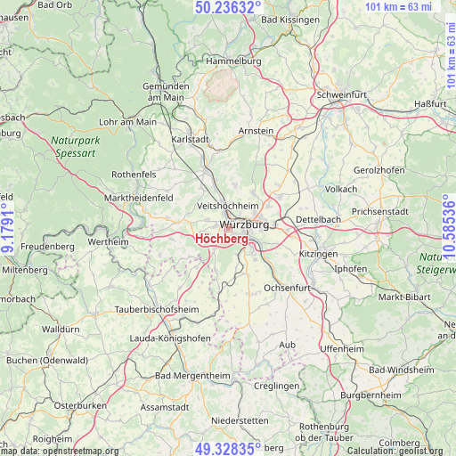
Höchberg GPS coordinates[2]
49° 47' 4.056" North, 9° 52' 56.028" East
| Map corner | latitude | longitude |
|---|---|---|
| Upper-left | 50.23632°, | 9.1791° |
| Center: | 49.78446°, | 9.88223° |
| Lower-right: | 49.32835°, | 10.58536° |
| Map W x H: | 101×101 km | = 62.8×62.8mi |
| max Lat: | 55.01917° ⇑69.3% North |
| Höchberg: | 49.78446° |
| min Lat: | ⇓30.7% South 47.40724° |
| min Long | Höchberg | max Long |
| 5.92978° | 9.88223° | 14.98853° |
| W 48.3%⇐ | ⇒51.7% E |
Elevation
Elevation of Höchberg is 265 m = 869 ft, and this is 15.9 m = 52 ft above average elevation for this country.
| Max E: |
1256 m = 4121 ft | 44.1% |
| Höchberg | 265 m 869 ft | |
| Avg. | 249.1 m = 817 ft | |
Min E: |
-5 m = -16 ft | 55.9% |
See also: Germany elevation on elevation.city.
Geographical zone
Höchberg is located in North temperate zone (between Tropic of Cancer and the Arctic Circle). Distance of this North polar circle is 1865.7 km =1159.3 mi to North.| Distance of | km | miles | from Höchberg |
|---|---|---|---|
| North Pole | 4471.5 | 2778.5 | to North |
| Arctic Circle | 1865.7 | 1159.3 | to North |
| Tropic Cancer | 2929.6 | 1820.4 | to South |
| Equator | 5535.5 | 3439.6 | to South |


Nearby cities:
15 places around Höchberg: (largest is in red/bold)
• Eisingen
4.6 km =2.9 mi,  233°
233°
• Erlabrunn
8.8 km =5.5 mi,  341°
341°
• Gadheim
7 km =4.3 mi,  13°
13°
• Gerbrunn
8.1 km =5 mi,  97°
97°
• Greußenheim
9 km =5.6 mi,  293°
293°
• Hettstadt
5.1 km =3.2 mi, 289°
• Kist
5.4 km =3.4 mi,  210°
210°
• Margetshöchheim
6 km =3.7 mi,  347°
347°
• Randersacker
7.7 km =4.8 mi,  110°
110°
• Reichenberg
6.3 km =3.9 mi,  158°
158°
• Veitshöchheim
5.4 km =3.4 mi,  359°
359°
• Waldbrunn
6.3 km =3.9 mi,  243°
243°
• Waldbüttelbrunn
2.6 km =1.6 mi,  279°
279°
• Würzburg
5.1 km =3.2 mi,  78°
78°
• Zell am Main
3.2 km =2 mi, 343°
Sources, notices
• [Note1] Compared only with cities in Germany existing in our database
• [Src1] Map data: © OpenStreetMap contributors (CC-BY-SA)
• [Src2] Other city data from geonames.org with taken over terms of usage.
• [Src3] Geographical zone / Annual Mean Temperature by Robert A. Rohde @ Wikipedia
