Henfstädt geodata
Henfstädt (Thuringia) is a seat of a fourth-order administrative division; located in Germany in Europe/Berlin (GMT+2) time zone. With population of 361 people, there are 9822 cities with bigger population in this country. Compared to other cities in Germany, 52.5% of cities are located further ↑North; 60.5% of cities are located further ←West and 65.8% of cities have lower elevation than Henfstädt. Note1


Henfstädt GPS coordinates[2]
50° 30' 58.752" North, 10° 35' 14.604" East
| Map corner | latitude | longitude |
|---|---|---|
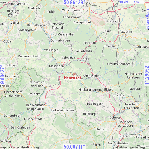
| Upper-left | 50.96129°, | 9.88427° |
| Center: | 50.51632°, | 10.58739° |
| Lower-right: | 50.06711°, | 11.29052° |
| Map W x H: | 99.4×99.4 km | = 61.8×61.8mi |
| max Lat: | 55.01917° ⇑52.5% North |
| Henfstädt: | 50.51632° |
| min Lat: | ⇓47.5% South 47.40724° |
| min Long | Henfstädt | max Long |
| 5.92978° | 10.58739° | 14.98853° |
| W 60.5%⇐ | ⇒39.5% E |
Elevation
Elevation of Henfstädt is 327 m = 1073 ft, and this is 77.9 m = 256 ft above average elevation for this country.
| Max E: |
1256 m = 4121 ft | 34.2% |
| Henfstädt | 327 m 1073 ft | |
| Avg. | 249.1 m = 817 ft | |
Min E: |
-5 m = -16 ft | 65.8% |
See also: Germany elevation on elevation.city.
Geographical zone
Henfstädt is located in North temperate zone (between Tropic of Cancer and the Arctic Circle). Distance of this North polar circle is 1784.3 km =1108.7 mi to North.| Distance of | km | miles | from Henfstädt |
|---|---|---|---|
| North Pole | 4390.2 | 2727.9 | to North |
| Arctic Circle | 1784.3 | 1108.7 | to North |
| Tropic Cancer | 3011 | 1870.9 | to South |
| Equator | 5616.9 | 3490.2 | to South |


Nearby cities:
15 places around Henfstädt: (largest is in red/bold)
• Beinerstadt
5.6 km =3.5 mi,  170°
170°
• Belrieth
6.6 km =4.1 mi,  282°
282°
• Bischofrod
5.8 km =3.6 mi,  49°
49°
• Ehrenberg
5.8 km =3.6 mi,  129°
129°
• Eichenberg
6.7 km =4.2 mi,  56°
56°
• Grimmelshausen
4.9 km =3 mi,  138°
138°
• Grub
5 km =3.1 mi,  40°
40°
• Kloster Veßra
4.8 km =3 mi,  112°
112°
• Lengfeld
4.8 km =3 mi,  66°
66°
• Leutersdorf
2.6 km =1.6 mi,  270°
270°
• Marisfeld
4.5 km =2.8 mi,  346°
346°
• Oberstadt
4.4 km =2.7 mi,  10°
10°
• Schmeheim
5.6 km =3.5 mi,  357°
357°
• Themar
2.4 km =1.5 mi,  123°
123°
• Vachdorf
3.7 km =2.3 mi,  287°
287°
Sources, notices
• [Note1] Compared only with cities in Germany existing in our database
• [Src1] Map data: © OpenStreetMap contributors (CC-BY-SA)
• [Src2] Other city data from geonames.org with taken over terms of usage.
• [Src3] Geographical zone / Annual Mean Temperature by Robert A. Rohde @ Wikipedia
