Ehrenberg geodata
Ehrenberg (Thuringia) is a seat of a fourth-order administrative division; located in Germany in Europe/Berlin (GMT+2) time zone. In our database, there are 11009 cities with bigger population. Compared to other cities in Germany, 53.2% of cities are located further ↑North; 61.6% of cities are located further ←West and 75.2% of cities have lower elevation than Ehrenberg. Note1


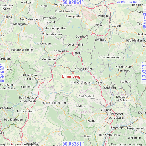
Ehrenberg GPS coordinates[2]
50° 28' 59.988" North, 10° 39' 0" East
| Map corner | latitude | longitude |
|---|---|---|
| Upper-left | 50.92861°, | 9.94687° |
| Center: | 50.48333°, | 10.65° |
| Lower-right: | 50.03381°, | 11.35313° |
| Map W x H: | 99.5×99.5 km | = 61.8×61.8mi |
| max Lat: | 55.01917° ⇑53.2% North |
| Ehrenberg: | 50.48333° |
| min Lat: | ⇓46.8% South 47.40724° |
| min Long | Ehrenberg | max Long |
| 5.92978° | 10.65° | 14.98853° |
| W 61.6%⇐ | ⇒38.4% E |
Elevation
Elevation of Ehrenberg is 399 m = 1309 ft, and this is 149.9 m = 492 ft above average elevation for this country.
| Max E: |
1256 m = 4121 ft | 24.8% |
| Ehrenberg | 399 m 1309 ft | |
| Avg. | 249.1 m = 817 ft | |
Min E: |
-5 m = -16 ft | 75.2% |
See also: Germany elevation on elevation.city.
Geographical zone
Ehrenberg is located in North temperate zone (between Tropic of Cancer and the Arctic Circle). Distance of this North polar circle is 1788 km =1111 mi to North.| Distance of | km | miles | from Ehrenberg |
|---|---|---|---|
| North Pole | 4393.8 | 2730.2 | to North |
| Arctic Circle | 1788 | 1111 | to North |
| Tropic Cancer | 3007.3 | 1868.6 | to South |
| Equator | 5613.2 | 3487.9 | to South |


Nearby cities:
15 places around Ehrenberg: (largest is in red/bold)
• Ahlstädt
6 km =3.7 mi,  22°
22°
• Beinerstadt
4 km =2.5 mi,  242°
242°
• Bischofrod
7.4 km =4.6 mi,  0°
0°
• Dingsleben
6.6 km =4.1 mi,  212°
212°
• Eichenberg
7.5 km =4.7 mi,  9°
9°
• Exdorf
8.2 km =5.1 mi,  249°
249°
• Grimmelshausen
1.2 km =0.7 mi,  270°
270°
• Grub
7.5 km =4.7 mi,  350°
350°
• Henfstädt
5.8 km =3.6 mi,  309°
309°
• Kloster Veßra
1.9 km =1.2 mi, 0°
• Lengfeld
5.6 km =3.5 mi, 0°
• Leutersdorf
8 km =5 mi,  297°
297°
• Reurieth
3.7 km =2.3 mi,  180°
180°
• Schleusingen
8.1 km =5 mi,  67°
67°
• Themar
3.4 km =2.1 mi, 314°
Sources, notices
• [Note1] Compared only with cities in Germany existing in our database
• [Src1] Map data: © OpenStreetMap contributors (CC-BY-SA)
• [Src2] Other city data from geonames.org with taken over terms of usage.
• [Src3] Geographical zone / Annual Mean Temperature by Robert A. Rohde @ Wikipedia
