Helpsen geodata
Helpsen (Lower Saxony) is a seat of a fourth-order administrative division; located in Germany in Europe/Berlin (GMT+2) time zone. With population of 2,005 people, there are 5062 cities with bigger population in this country. Compared to other cities in Germany, 75.3% of cities are located further ↓South; 63.7% of cities are located further →East and 76.4% of cities have higher elevation than Helpsen. Note1


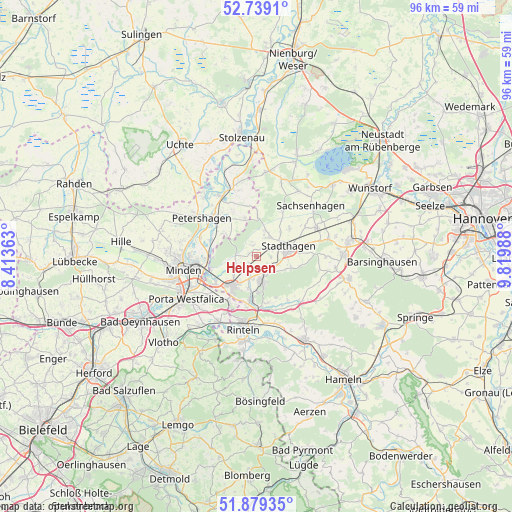
Helpsen GPS coordinates[2]
52° 18' 40.716" North, 9° 7' 0.336" East
| Map corner | latitude | longitude |
|---|---|---|
| Upper-left | 52.7391°, | 8.41363° |
| Center: | 52.31131°, | 9.11676° |
| Lower-right: | 51.87935°, | 9.81988° |
| Map W x H: | 95.6×95.6 km | = 59.4×59.4mi |
| max Lat: | 55.01917° ⇑24.7% North |
| Helpsen: | 52.31131° |
| min Lat: | ⇓75.3% South 47.40724° |
| min Long | Helpsen | max Long |
| 5.92978° | 9.11676° | 14.98853° |
| W 36.3%⇐ | ⇒63.7% E |
Elevation
Elevation of Helpsen is 58 m = 190 ft, and this is 191.1 m = 627 ft below average elevation for this country.
| Max E: |
1256 m = 4121 ft | 76.4% |
| Avg. | 249.1 m = 817 ft | |
| Helpsen | 58 m = 190 ft | |
Min E: |
-5 m = -16 ft | 23.6% |
See also: Germany elevation on elevation.city.
Geographical zone
Helpsen is located in North temperate zone (between Tropic of Cancer and the Arctic Circle). Distance of this North polar circle is 1584.7 km =984.7 mi to North.| Distance of | km | miles | from Helpsen |
|---|---|---|---|
| North Pole | 4190.6 | 2603.9 | to North |
| Arctic Circle | 1584.7 | 984.7 | to North |
| Tropic Cancer | 3210.6 | 1995 | to South |
| Equator | 5816.5 | 3614.2 | to South |


Nearby cities:
15 places around Helpsen: (largest is in red/bold)
• Ahnsen
6.4 km =4 mi,  189°
189°
• Bad Eilsen
7.8 km =4.8 mi, 189°
• Bückeburg
7.3 km =4.5 mi,  219°
219°
• Heeßen
8.9 km =5.5 mi, 188°
• Hespe
2.2 km =1.4 mi,  344°
344°
• Lauenhagen
7.8 km =4.8 mi,  51°
51°
• Meerbeck
4.1 km =2.5 mi,  34°
34°
• Niedernwöhren
5 km =3.1 mi,  24°
24°
• Nienstädt
3.9 km =2.4 mi,  122°
122°
• Nordsehl
6.2 km =3.9 mi, 46°
• Obernkirchen
4.4 km =2.7 mi,  169°
169°
• Pollhagen
9.5 km =5.9 mi, 30°
• Seggebruch
1.9 km =1.2 mi,  231°
231°
• Stadthagen
6 km =3.7 mi,  77°
77°
• Wiedensahl
8.1 km =5 mi,  1°
1°
Sources, notices
• [Note1] Compared only with cities in Germany existing in our database
• [Src1] Map data: © OpenStreetMap contributors (CC-BY-SA)
• [Src2] Other city data from geonames.org with taken over terms of usage.
• [Src3] Geographical zone / Annual Mean Temperature by Robert A. Rohde @ Wikipedia
