Niedernwöhren geodata
Niedernwöhren (Lower Saxony) is a seat of a fourth-order administrative division; located in Germany in Europe/Berlin (GMT+2) time zone. With population of 2,061 people, there are 4981 cities with bigger population in this country. Compared to other cities in Germany, 75.7% of cities are located further ↓South; 63.3% of cities are located further →East and 75.3% of cities have higher elevation than Niedernwöhren. Note1
Administrative division(s):
- Level 1: Lower Saxony
- Level 3: Landkreis Schaumburg
- Level 4: Niedernwöhren


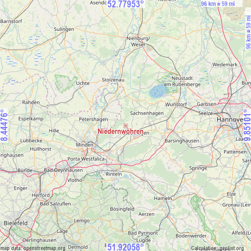
Niedernwöhren GPS coordinates[2]
52° 21' 7.704" North, 9° 8' 52.368" East
| Map corner | latitude | longitude |
|---|---|---|
| Upper-left | 52.77953°, | 8.44476° |
| Center: | 52.35214°, | 9.14788° |
| Lower-right: | 51.92058°, | 9.85101° |
| Map W x H: | 95.5×95.5 km | = 59.3×59.3mi |
| max Lat: | 55.01917° ⇑24.3% North |
| Niedernwöhren: | 52.35214° |
| min Lat: | ⇓75.7% South 47.40724° |
| min Long | Niedernwöhren | max Long |
| 5.92978° | 9.14788° | 14.98853° |
| W 36.7%⇐ | ⇒63.3% E |
Elevation
Elevation of Niedernwöhren is 62 m = 203 ft, and this is 187.1 m = 614 ft below average elevation for this country.
| Max E: |
1256 m = 4121 ft | 75.3% |
| Avg. | 249.1 m = 817 ft | |
| Niedernwöhren | 62 m = 203 ft | |
Min E: |
-5 m = -16 ft | 24.7% |
See also: Germany elevation on elevation.city.
Geographical zone
Niedernwöhren is located in North temperate zone (between Tropic of Cancer and the Arctic Circle). Distance of this North polar circle is 1580.2 km =981.9 mi to North.| Distance of | km | miles | from Niedernwöhren |
|---|---|---|---|
| North Pole | 4186 | 2601.1 | to North |
| Arctic Circle | 1580.2 | 981.9 | to North |
| Tropic Cancer | 3215.1 | 1997.8 | to South |
| Equator | 5821 | 3617 | to South |


Nearby cities:
15 places around Niedernwöhren: (largest is in red/bold)
• Helpsen
5 km =3.1 mi,  204°
204°
• Hespe
3.7 km =2.3 mi,  227°
227°
• Heuerßen
9.1 km =5.7 mi,  106°
106°
• Lauenhagen
4 km =2.5 mi,  84°
84°
• Lindhorst
9.2 km =5.7 mi,  86°
86°
• Lüdersfeld
7.3 km =4.5 mi, 83°
• Meerbeck
1.2 km =0.7 mi,  170°
170°
• Nienstädt
6.7 km =4.2 mi, 170°
• Nordsehl
2.4 km =1.5 mi,  95°
95°
• Obernkirchen
9 km =5.6 mi,  188°
188°
• Pollhagen
4.6 km =2.9 mi,  36°
36°
• Seggebruch
6.8 km =4.2 mi,  212°
212°
• Stadthagen
4.9 km =3 mi,  130°
130°
• Wiedensahl
4 km =2.5 mi,  331°
331°
• Wölpinghausen
9.2 km =5.7 mi, 38°
Sources, notices
• [Note1] Compared only with cities in Germany existing in our database
• [Src1] Map data: © OpenStreetMap contributors (CC-BY-SA)
• [Src2] Other city data from geonames.org with taken over terms of usage.
• [Src3] Geographical zone / Annual Mean Temperature by Robert A. Rohde @ Wikipedia
