Heinrichswalde geodata
Heinrichswalde (Mecklenburg-Vorpommern) is a populated place; located in Germany in Europe/Berlin (GMT+2) time zone. With population of 564 people, there are 9006 cities with bigger population in this country. Compared to other cities in Germany, 87.2% of cities are located further ↓South; 97.2% of cities are located further ←West and 92% of cities have higher elevation than Heinrichswalde. Note1
Administrative division(s):
- Level 1: Mecklenburg-Vorpommern
- Level 3: Vorpommern-Greifswald
- Level 4: Heinrichswalde


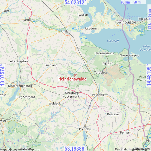
Heinrichswalde GPS coordinates[2]
53° 36' 47.016" North, 13° 46' 43.896" East
| Map corner | latitude | longitude |
|---|---|---|
| Upper-left | 54.02812°, | 13.07574° |
| Center: | 53.61306°, | 13.77886° |
| Lower-right: | 53.19388°, | 14.48199° |
| Map W x H: | 92.8×92.8 km | = 57.7×57.7mi |
| max Lat: | 55.01917° ⇑12.8% North |
| Heinrichswalde: | 53.61306° |
| min Lat: | ⇓87.2% South 47.40724° |
| min Long | Heinrichswalde | max Long |
| 5.92978° | 13.77886° | 14.98853° |
| W 97.2%⇐ | ⇒2.8% E |
Elevation
Elevation of Heinrichswalde is 16 m = 52 ft, and this is 233.1 m = 765 ft below average elevation for this country.
| Max E: |
1256 m = 4121 ft | 92% |
| Avg. | 249.1 m = 817 ft | |
| Heinrichswalde | 16 m = 52 ft | |
Min E: |
-5 m = -16 ft | 8% |
See also: Germany elevation on elevation.city.
Geographical zone
Heinrichswalde is located in North temperate zone (between Tropic of Cancer and the Arctic Circle). Distance of this North polar circle is 1440 km =894.8 mi to North.| Distance of | km | miles | from Heinrichswalde |
|---|---|---|---|
| North Pole | 4045.8 | 2513.9 | to North |
| Arctic Circle | 1440 | 894.8 | to North |
| Tropic Cancer | 3355.3 | 2084.9 | to South |
| Equator | 5961.2 | 3704.1 | to South |


Nearby cities:
15 places around Heinrichswalde: (largest is in red/bold)
• Boldekow
17.3 km =10.7 mi,  315°
315°
• Ducherow
16.8 km =10.4 mi,  0°
0°
• Eichhorst
18.7 km =11.6 mi,  263°
263°
• Ferdinandshof
8.9 km =5.5 mi,  53°
53°
• Friedland
16.1 km =10 mi,  293°
293°
• Groß Miltzow
15 km =9.3 mi,  234°
234°
• Hammer
13.4 km =8.3 mi,  95°
95°
• Jatznick
11.2 km =7 mi,  109°
109°
• Pasewalk
18.3 km =11.4 mi,  130°
130°
• Schönbeck
14.1 km =8.8 mi, 255°
• Schönwalde
11.3 km =7 mi, 132°
• Strasburg
11.6 km =7.2 mi,  191°
191°
• Torgelow
15.6 km =9.7 mi,  81°
81°
• Viereck
18.7 km =11.6 mi, 112°
• Wilhelmsburg
6.2 km =3.9 mi,  58°
58°
Sources, notices
• [Note1] Compared only with cities in Germany existing in our database
• [Src1] Map data: © OpenStreetMap contributors (CC-BY-SA)
• [Src2] Other city data from geonames.org with taken over terms of usage.
• [Src3] Geographical zone / Annual Mean Temperature by Robert A. Rohde @ Wikipedia
