Ducherow geodata
Ducherow (Mecklenburg-Vorpommern) is a populated place; located in Germany in Europe/Berlin (GMT+2) time zone. With population of 2,246 people, there are 4751 cities with bigger population in this country. Compared to other cities in Germany, 89.5% of cities are located further ↓South; 97.2% of cities are located further ←West and 95.6% of cities have higher elevation than Ducherow. Note1
Administrative division(s):
- Level 1: Mecklenburg-Vorpommern
- Level 3: Vorpommern-Greifswald
- Level 4: Ducherow


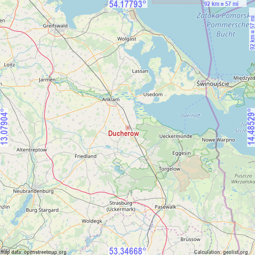
Ducherow GPS coordinates[2]
53° 45' 51.696" North, 13° 46' 55.776" East
| Map corner | latitude | longitude |
|---|---|---|
| Upper-left | 54.17793°, | 13.07904° |
| Center: | 53.76436°, | 13.78216° |
| Lower-right: | 53.34668°, | 14.48529° |
| Map W x H: | 92.4×92.4 km | = 57.4×57.4mi |
| max Lat: | 55.01917° ⇑10.5% North |
| Ducherow: | 53.76436° |
| min Lat: | ⇓89.5% South 47.40724° |
| min Long | Ducherow | max Long |
| 5.92978° | 13.78216° | 14.98853° |
| W 97.2%⇐ | ⇒2.8% E |
Elevation
Elevation of Ducherow is 7 m = 23 ft, and this is 242.1 m = 794 ft below average elevation for this country.
| Max E: |
1256 m = 4121 ft | 95.6% |
| Avg. | 249.1 m = 817 ft | |
| Ducherow | 7 m = 23 ft | |
Min E: |
-5 m = -16 ft | 4.4% |
See also: Germany elevation on elevation.city.
Geographical zone
Ducherow is located in North temperate zone (between Tropic of Cancer and the Arctic Circle). Distance of this North polar circle is 1423.1 km =884.3 mi to North.| Distance of | km | miles | from Ducherow |
|---|---|---|---|
| North Pole | 4029 | 2503.5 | to North |
| Arctic Circle | 1423.1 | 884.3 | to North |
| Tropic Cancer | 3372.1 | 2095.3 | to South |
| Equator | 5978 | 3714.6 | to South |


Nearby cities:
15 places around Ducherow: (largest is in red/bold)
• Alt-Sanitz
13.9 km =8.6 mi,  293°
293°
• Anklam
11.9 km =7.4 mi,  329°
329°
• Boldekow
13.1 km =8.1 mi,  250°
250°
• Ferdinandshof
13.4 km =8.3 mi,  148°
148°
• Friedland
18.3 km =11.4 mi,  235°
235°
• Heinrichswalde
16.8 km =10.4 mi,  180°
180°
• Leopoldshagen
7.4 km =4.6 mi,  81°
81°
• Liepgarten
16.9 km =10.5 mi,  107°
107°
• Murchin
16.1 km =10 mi,  350°
350°
• Mönkebude
12.3 km =7.6 mi,  88°
88°
• Neu Kosenow
3.8 km =2.4 mi, 328°
• Spantekow
17.5 km =10.9 mi,  274°
274°
• Ueckermünde
17.5 km =10.9 mi,  99°
99°
• Usedom
15.5 km =9.6 mi,  37°
37°
• Wilhelmsburg
14.5 km =9 mi,  159°
159°
Sources, notices
• [Note1] Compared only with cities in Germany existing in our database
• [Src1] Map data: © OpenStreetMap contributors (CC-BY-SA)
• [Src2] Other city data from geonames.org with taken over terms of usage.
• [Src3] Geographical zone / Annual Mean Temperature by Robert A. Rohde @ Wikipedia
