Eichhorst geodata
Eichhorst (Mecklenburg-Vorpommern) is a populated place; located in Germany in Europe/Berlin (GMT+2) time zone. With population of 568 people, there are 8987 cities with bigger population in this country. Compared to other cities in Germany, 86.9% of cities are located further ↓South; 95.7% of cities are located further ←West and 74.5% of cities have higher elevation than Eichhorst. Note1
Administrative division(s):
- Level 1: Mecklenburg-Vorpommern
- Level 3: Mecklenburgische Seenplatte
- Level 4: Friedland


Eichhorst GPS coordinates[2]
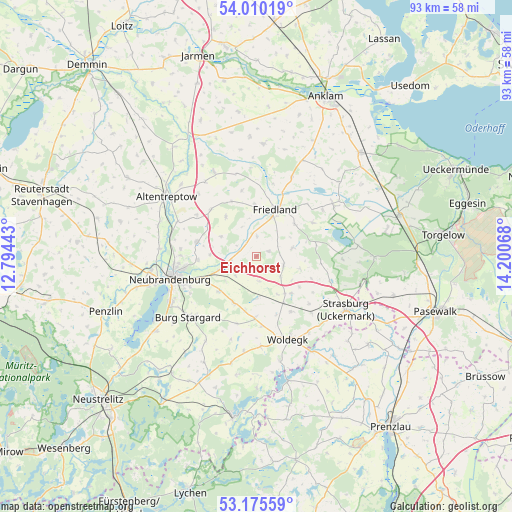
53° 35' 41.82" North, 13° 29' 51.18" East
| Map corner | latitude | longitude |
|---|---|---|
| Upper-left | 54.01019°, | 12.79443° |
| Center: | 53.59495°, | 13.49755° |
| Lower-right: | 53.17559°, | 14.20068° |
| Map W x H: | 92.8×92.8 km | = 57.7×57.7mi |
| max Lat: | 55.01917° ⇑13.1% North |
| Eichhorst: | 53.59495° |
| min Lat: | ⇓86.9% South 47.40724° |
| min Long | Eichhorst | max Long |
| 5.92978° | 13.49755° | 14.98853° |
| W 95.7%⇐ | ⇒4.3% E |
Elevation
Elevation of Eichhorst is 65 m = 213 ft, and this is 184.1 m = 604 ft below average elevation for this country.
| Max E: |
1256 m = 4121 ft | 74.5% |
| Avg. | 249.1 m = 817 ft | |
| Eichhorst | 65 m = 213 ft | |
Min E: |
-5 m = -16 ft | 25.5% |
See also: Germany elevation on elevation.city.
Geographical zone
Eichhorst is located in North temperate zone (between Tropic of Cancer and the Arctic Circle). Distance of this North polar circle is 1442 km =896 mi to North.| Distance of | km | miles | from Eichhorst |
|---|---|---|---|
| North Pole | 4047.9 | 2515.2 | to North |
| Arctic Circle | 1442 | 896 | to North |
| Tropic Cancer | 3353.3 | 2083.6 | to South |
| Equator | 5959.2 | 3702.9 | to South |


Nearby cities:
15 places around Eichhorst: (largest is in red/bold)
• Boldekow
15.7 km =9.8 mi,  23°
23°
• Brunn
11.9 km =7.4 mi,  315°
315°
• Burg Stargard
16.5 km =10.3 mi,  228°
228°
• Cölpin
9.2 km =5.7 mi,  206°
206°
• Friedland
9.2 km =5.7 mi, 23°
• Groß Miltzow
9.1 km =5.7 mi,  136°
136°
• Neubrandenburg
15.1 km =9.4 mi,  256°
256°
• Neuenkirchen
8.5 km =5.3 mi,  271°
271°
• Neverin
11 km =6.8 mi,  285°
285°
• Pragsdorf
9.2 km =5.7 mi, 227°
• Rossow
10.3 km =6.4 mi,  300°
300°
• Schönbeck
5.1 km =3.2 mi,  106°
106°
• Staven
7.2 km =4.5 mi, 300°
• Trollenhagen
13.7 km =8.5 mi,  275°
275°
• Woldegk
16 km =9.9 mi,  159°
159°
Sources, notices
• [Note1] Compared only with cities in Germany existing in our database
• [Src1] Map data: © OpenStreetMap contributors (CC-BY-SA)
• [Src2] Other city data from geonames.org with taken over terms of usage.
• [Src3] Geographical zone / Annual Mean Temperature by Robert A. Rohde @ Wikipedia
