Hagelstadt geodata
Hagelstadt (Bavaria) is a seat of a fourth-order administrative division; located in Germany in Europe/Berlin (GMT+2) time zone. With population of 1,852 people, there are 5273 cities with bigger population in this country. Compared to other cities in Germany, 84.1% of cities are located further ↑North; 84.8% of cities are located further ←West and 70.4% of cities have lower elevation than Hagelstadt. Note1
Administrative division(s):
- Level 1: Bavaria
- Level 2: Upper Palatinate
- Level 3: Landkreis Regensburg
- Level 4: Hagelstadt


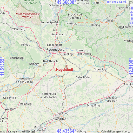
Hagelstadt GPS coordinates[2]
48° 54' 0" North, 12° 13' 0.012" East
| Map corner | latitude | longitude |
|---|---|---|
| Upper-left | 49.36008°, | 11.51355° |
| Center: | 48.9°, | 12.21667° |
| Lower-right: | 48.43564°, | 12.9198° |
| Map W x H: | 102.8×102.8 km | = 63.9×63.9mi |
| max Lat: | 55.01917° ⇑84.1% North |
| Hagelstadt: | 48.9° |
| min Lat: | ⇓15.9% South 47.40724° |
| min Long | Hagelstadt | max Long |
| 5.92978° | 12.21667° | 14.98853° |
| W 84.8%⇐ | ⇒15.2% E |
Elevation
Elevation of Hagelstadt is 361 m = 1184 ft, and this is 111.9 m = 367 ft above average elevation for this country.
| Max E: |
1256 m = 4121 ft | 29.6% |
| Hagelstadt | 361 m 1184 ft | |
| Avg. | 249.1 m = 817 ft | |
Min E: |
-5 m = -16 ft | 70.4% |
See also: Germany elevation on elevation.city.
Geographical zone
Hagelstadt is located in North temperate zone (between Tropic of Cancer and the Arctic Circle). Distance of this North polar circle is 1964 km =1220.4 mi to North.| Distance of | km | miles | from Hagelstadt |
|---|---|---|---|
| North Pole | 4569.9 | 2839.6 | to North |
| Arctic Circle | 1964 | 1220.4 | to North |
| Tropic Cancer | 2831.3 | 1759.3 | to South |
| Equator | 5437.2 | 3378.5 | to South |


Nearby cities:
15 places around Hagelstadt: (largest is in red/bold)
• Alteglofsheim
2.2 km =1.4 mi,  326°
326°
• Aufhausen
5.7 km =3.5 mi,  123°
123°
• Bad Abbach
13.2 km =8.2 mi,  288°
288°
• Barbing
11.2 km =7 mi,  353°
353°
• Köfering
3.9 km =2.4 mi,  341°
341°
• Laberweinting
13.3 km =8.3 mi,  146°
146°
• Mintraching
6.2 km =3.9 mi,  17°
17°
• Mötzing
11.5 km =7.1 mi,  93°
93°
• Neutraubling
9.8 km =6.1 mi, 353°
• Obertraubling
8.3 km =5.2 mi, 333°
• Pfakofen
4.7 km =2.9 mi,  170°
170°
• Riekofen
9.9 km =6.2 mi,  79°
79°
• Schierling
9.2 km =5.7 mi,  217°
217°
• Sünching
10.1 km =6.3 mi,  103°
103°
• Thalmassing
4.7 km =2.9 mi, 286°
Sources, notices
• [Note1] Compared only with cities in Germany existing in our database
• [Src1] Map data: © OpenStreetMap contributors (CC-BY-SA)
• [Src2] Other city data from geonames.org with taken over terms of usage.
• [Src3] Geographical zone / Annual Mean Temperature by Robert A. Rohde @ Wikipedia
