Schierling geodata
Schierling (Bavaria) is a populated place; located in Germany in Europe/Berlin (GMT+2) time zone. With population of 7,347 people, there are 2103 cities with bigger population in this country. Compared to other cities in Germany, 84.9% of cities are located further ↑North; 83.8% of cities are located further ←West and 72.6% of cities have lower elevation than Schierling. Note1
Administrative division(s):
- Level 1: Bavaria
- Level 2: Upper Palatinate
- Level 3: Landkreis Regensburg
- Level 4: Schierling, Markt


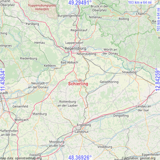
Schierling GPS coordinates[2]
48° 50' 3.192" North, 12° 8' 22.056" East
| Map corner | latitude | longitude |
|---|---|---|
| Upper-left | 49.29491°, | 11.43634° |
| Center: | 48.83422°, | 12.13946° |
| Lower-right: | 48.36926°, | 12.84259° |
| Map W x H: | 102.9×102.9 km | = 63.9×63.9mi |
| max Lat: | 55.01917° ⇑84.9% North |
| Schierling: | 48.83422° |
| min Lat: | ⇓15.1% South 47.40724° |
| min Long | Schierling | max Long |
| 5.92978° | 12.13946° | 14.98853° |
| W 83.8%⇐ | ⇒16.2% E |
Elevation
Elevation of Schierling is 379 m = 1243 ft, and this is 129.9 m = 426 ft above average elevation for this country.
| Max E: |
1256 m = 4121 ft | 27.4% |
| Schierling | 379 m 1243 ft | |
| Avg. | 249.1 m = 817 ft | |
Min E: |
-5 m = -16 ft | 72.6% |
See also: Germany elevation on elevation.city.
Geographical zone
Schierling is located in North temperate zone (between Tropic of Cancer and the Arctic Circle). Distance of this North polar circle is 1971.3 km =1224.9 mi to North.| Distance of | km | miles | from Schierling |
|---|---|---|---|
| North Pole | 4577.2 | 2844.1 | to North |
| Arctic Circle | 1971.3 | 1224.9 | to North |
| Tropic Cancer | 2823.9 | 1754.7 | to South |
| Equator | 5429.9 | 3374 | to South |


Nearby cities:
15 places around Schierling: (largest is in red/bold)
• Alteglofsheim
10.2 km =6.3 mi,  25°
25°
• Aufhausen
11.3 km =7 mi,  68°
68°
• Bad Abbach
13.4 km =8.3 mi,  328°
328°
• Hagelstadt
9.2 km =5.7 mi,  37°
37°
• Hausen
10.1 km =6.3 mi,  286°
286°
• Herrngiersdorf
7.1 km =4.4 mi,  224°
224°
• Köfering
11.9 km =7.4 mi,  21°
21°
• Laberweinting
13.5 km =8.4 mi,  106°
106°
• Langquaid
6.6 km =4.1 mi,  259°
259°
• Mallersdorf-Pfaffenberg
10.1 km =6.3 mi,  138°
138°
• Obertraubling
14.9 km =9.3 mi,  7°
7°
• Pfakofen
7 km =4.3 mi, 67°
• Rohr
14.4 km =8.9 mi,  238°
238°
• Teugn
11.4 km =7.1 mi,  304°
304°
• Thalmassing
8.7 km =5.4 mi, 7°
Sources, notices
• [Note1] Compared only with cities in Germany existing in our database
• [Src1] Map data: © OpenStreetMap contributors (CC-BY-SA)
• [Src2] Other city data from geonames.org with taken over terms of usage.
• [Src3] Geographical zone / Annual Mean Temperature by Robert A. Rohde @ Wikipedia
