Grabow geodata
Grabow (Saxony-Anhalt) is a populated place; located in Germany in Europe/Berlin (GMT+2) time zone. With population of 741 people, there are 8146 cities with bigger population in this country. Compared to other cities in Germany, 74.6% of cities are located further ↓South; 81.3% of cities are located further ←West and 78.7% of cities have higher elevation than Grabow. Note1


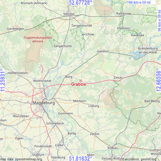
Grabow GPS coordinates[2]
52° 14' 56.004" North, 11° 57' 44.748" East
| Map corner | latitude | longitude |
|---|---|---|
| Upper-left | 52.67728°, | 11.25931° |
| Center: | 52.24889°, | 11.96243° |
| Lower-right: | 51.81632°, | 12.66556° |
| Map W x H: | 95.7×95.7 km | = 59.5×59.5mi |
| max Lat: | 55.01917° ⇑25.4% North |
| Grabow: | 52.24889° |
| min Lat: | ⇓74.6% South 47.40724° |
| min Long | Grabow | max Long |
| 5.92978° | 11.96243° | 14.98853° |
| W 81.3%⇐ | ⇒18.7% E |
Elevation
Elevation of Grabow is 51 m = 167 ft, and this is 198.1 m = 650 ft below average elevation for this country.
| Max E: |
1256 m = 4121 ft | 78.7% |
| Avg. | 249.1 m = 817 ft | |
| Grabow | 51 m = 167 ft | |
Min E: |
-5 m = -16 ft | 21.3% |
See also: Germany elevation on elevation.city.
Geographical zone
Grabow is located in North temperate zone (between Tropic of Cancer and the Arctic Circle). Distance of this North polar circle is 1591.6 km =989 mi to North.| Distance of | km | miles | from Grabow |
|---|---|---|---|
| North Pole | 4197.5 | 2608.2 | to North |
| Arctic Circle | 1591.6 | 989 | to North |
| Tropic Cancer | 3203.6 | 1990.6 | to South |
| Equator | 5809.5 | 3609.9 | to South |


Nearby cities:
15 places around Grabow: (largest is in red/bold)
• Burg bei Magdeburg
7.7 km =4.8 mi,  288°
288°
• Gladau
10.7 km =6.6 mi,  54°
54°
• Hohenziatz
9.6 km =6 mi,  141°
141°
• Körbelitz
14.4 km =8.9 mi,  238°
238°
• Loburg
16.8 km =10.4 mi,  152°
152°
• Lostau
15.9 km =9.9 mi,  253°
253°
• Möckern
12 km =7.5 mi,  183°
183°
• Möser
12.2 km =7.6 mi, 251°
• Nedlitz
16.1 km =10 mi,  213°
213°
• Reesen
4.3 km =2.7 mi,  337°
337°
• Rogätz
15.3 km =9.5 mi,  299°
299°
• Schermen
10.3 km =6.4 mi,  259°
259°
• Theeßen
6 km =3.7 mi,  99°
99°
• Tucheim
15.7 km =9.8 mi,  73°
73°
• Zeppernick
14.3 km =8.9 mi,  163°
163°
Sources, notices
• [Note1] Compared only with cities in Germany existing in our database
• [Src1] Map data: © OpenStreetMap contributors (CC-BY-SA)
• [Src2] Other city data from geonames.org with taken over terms of usage.
• [Src3] Geographical zone / Annual Mean Temperature by Robert A. Rohde @ Wikipedia
