Hohenziatz geodata
Hohenziatz (Saxony-Anhalt) is a populated place; located in Germany in Europe/Berlin (GMT+2) time zone. With population of 599 people, there are 8836 cities with bigger population in this country. Compared to other cities in Germany, 73.8% of cities are located further ↓South; 82.4% of cities are located further ←West and 71.8% of cities have higher elevation than Hohenziatz. Note1


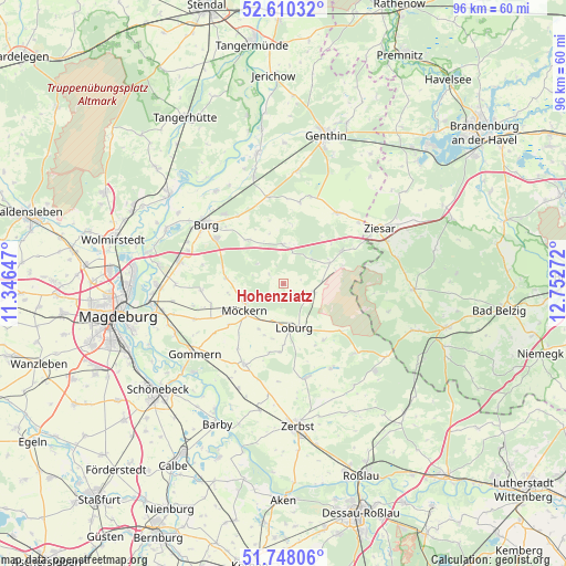
Hohenziatz GPS coordinates[2]
52° 10' 52.608" North, 12° 2' 58.524" East
| Map corner | latitude | longitude |
|---|---|---|
| Upper-left | 52.61032°, | 11.34647° |
| Center: | 52.18128°, | 12.04959° |
| Lower-right: | 51.74806°, | 12.75272° |
| Map W x H: | 95.9×95.9 km | = 59.6×59.6mi |
| max Lat: | 55.01917° ⇑26.2% North |
| Hohenziatz: | 52.18128° |
| min Lat: | ⇓73.8% South 47.40724° |
| min Long | Hohenziatz | max Long |
| 5.92978° | 12.04959° | 14.98853° |
| W 82.4%⇐ | ⇒17.6% E |
Elevation
Elevation of Hohenziatz is 79 m = 259 ft, and this is 170.1 m = 558 ft below average elevation for this country.
| Max E: |
1256 m = 4121 ft | 71.8% |
| Avg. | 249.1 m = 817 ft | |
| Hohenziatz | 79 m = 259 ft | |
Min E: |
-5 m = -16 ft | 28.2% |
See also: Germany elevation on elevation.city.
Geographical zone
Hohenziatz is located in North temperate zone (between Tropic of Cancer and the Arctic Circle). Distance of this North polar circle is 1599.2 km =993.7 mi to North.| Distance of | km | miles | from Hohenziatz |
|---|---|---|---|
| North Pole | 4205 | 2612.9 | to North |
| Arctic Circle | 1599.2 | 993.7 | to North |
| Tropic Cancer | 3196.1 | 1986 | to South |
| Equator | 5802 | 3605.2 | to South |


Nearby cities:
15 places around Hohenziatz: (largest is in red/bold)
• Burg bei Magdeburg
16.6 km =10.3 mi,  307°
307°
• Deetz
16.6 km =10.3 mi,  150°
150°
• Gladau
14 km =8.7 mi,  11°
11°
• Grabow
9.6 km =6 mi,  321°
321°
• Leitzkau
15.2 km =9.4 mi,  205°
205°
• Lindau
16.5 km =10.3 mi,  166°
166°
• Loburg
7.6 km =4.7 mi, 165°
• Möckern
8 km =5 mi,  236°
236°
• Nedlitz
16 km =9.9 mi,  248°
248°
• Reesen
13.7 km =8.5 mi,  326°
326°
• Rosian
11.8 km =7.3 mi,  143°
143°
• Schermen
17 km =10.6 mi,  289°
289°
• Theeßen
6.6 km =4.1 mi,  359°
359°
• Tucheim
15.1 km =9.4 mi,  37°
37°
• Zeppernick
6.5 km =4 mi,  196°
196°
Sources, notices
• [Note1] Compared only with cities in Germany existing in our database
• [Src1] Map data: © OpenStreetMap contributors (CC-BY-SA)
• [Src2] Other city data from geonames.org with taken over terms of usage.
• [Src3] Geographical zone / Annual Mean Temperature by Robert A. Rohde @ Wikipedia
