Frohburg geodata
Frohburg (Saxony) is a populated place; located in Germany in Europe/Berlin (GMT+2) time zone. With population of 7,983 people, there are 1958 cities with bigger population in this country. Compared to other cities in Germany, 59.1% of cities are located further ↓South; 88.5% of cities are located further ←West and 58.1% of cities have higher elevation than Frohburg. Note1


Frohburg GPS coordinates[2]
51° 3' 25.884" North, 12° 33' 26.856" East
| Map corner | latitude | longitude |
|---|---|---|
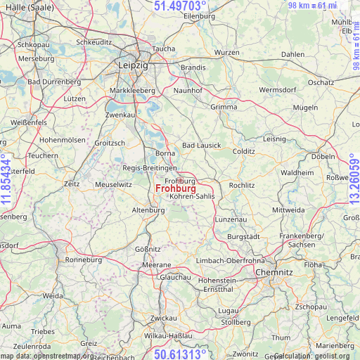
| Upper-left | 51.49703°, | 11.85434° |
| Center: | 51.05719°, | 12.55746° |
| Lower-right: | 50.61313°, | 13.26059° |
| Map W x H: | 98.3×98.3 km | = 61.1×61.1mi |
| max Lat: | 55.01917° ⇑40.9% North |
| Frohburg: | 51.05719° |
| min Lat: | ⇓59.1% South 47.40724° |
| min Long | Frohburg | max Long |
| 5.92978° | 12.55746° | 14.98853° |
| W 88.5%⇐ | ⇒11.5% E |
Elevation
Elevation of Frohburg is 167 m = 548 ft, and this is 82.1 m = 269 ft below average elevation for this country.
| Max E: |
1256 m = 4121 ft | 58.1% |
| Avg. | 249.1 m = 817 ft | |
| Frohburg | 167 m = 548 ft | |
Min E: |
-5 m = -16 ft | 41.9% |
See also: Germany elevation on elevation.city.
Geographical zone
Frohburg is located in North temperate zone (between Tropic of Cancer and the Arctic Circle). Distance of this North polar circle is 1724.1 km =1071.3 mi to North.| Distance of | km | miles | from Frohburg |
|---|---|---|---|
| North Pole | 4330 | 2690.5 | to North |
| Arctic Circle | 1724.1 | 1071.3 | to North |
| Tropic Cancer | 3071.1 | 1908.3 | to South |
| Equator | 5677 | 3527.5 | to South |


Nearby cities:
15 places around Frohburg: (largest is in red/bold)
• Altenburg
11.4 km =7.1 mi,  227°
227°
• Bad Lausick
11.5 km =7.1 mi,  31°
31°
• Borna
8.6 km =5.3 mi,  330°
330°
• Deutzen
11.1 km =6.9 mi,  303°
303°
• Fockendorf
6.4 km =4 mi,  262°
262°
• Geithain
9.7 km =6 mi,  91°
91°
• Gerstenberg
8.9 km =5.5 mi,  250°
250°
• Haselbach
8.7 km =5.4 mi,  276°
276°
• Kitzscher
11.9 km =7.4 mi,  358°
358°
• Langenleuba-Niederhain
11 km =6.8 mi,  168°
168°
• Lobstädt
11.4 km =7.1 mi,  318°
318°
• Nobitz
10.3 km =6.4 mi,  209°
209°
• Regis-Breitingen
9 km =5.6 mi,  292°
292°
• Treben
9.9 km =6.2 mi,  265°
265°
• Windischleuba
7.7 km =4.8 mi, 233°
Sources, notices
• [Note1] Compared only with cities in Germany existing in our database
• [Src1] Map data: © OpenStreetMap contributors (CC-BY-SA)
• [Src2] Other city data from geonames.org with taken over terms of usage.
• [Src3] Geographical zone / Annual Mean Temperature by Robert A. Rohde @ Wikipedia
