Freimersheim geodata
Freimersheim (Rheinland-Pfalz) is a seat of a fourth-order administrative division; located in Germany in Europe/Berlin (GMT+2) time zone. With population of 603 people, there are 8800 cities with bigger population in this country. Compared to other cities in Germany, 71.2% of cities are located further ↑North; 75.6% of cities are located further →East and 52.5% of cities have lower elevation than Freimersheim. Note1
Administrative division(s):
- Level 1: Rheinland-Pfalz
- Level 3: Landkreis Alzey-Worms
- Level 4: Freimersheim


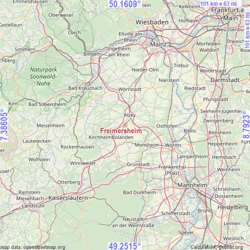
Freimersheim GPS coordinates[2]
49° 42' 29.988" North, 8° 5' 21.012" East
| Map corner | latitude | longitude |
|---|---|---|
| Upper-left | 50.1609°, | 7.38605° |
| Center: | 49.70833°, | 8.08917° |
| Lower-right: | 49.2515°, | 8.7923° |
| Map W x H: | 101.1×101.1 km | = 62.8×62.8mi |
| max Lat: | 55.01917° ⇑71.2% North |
| Freimersheim: | 49.70833° |
| min Lat: | ⇓28.8% South 47.40724° |
| min Long | Freimersheim | max Long |
| 5.92978° | 8.08917° | 14.98853° |
| W 24.4%⇐ | ⇒75.6% E |
Elevation
Elevation of Freimersheim is 243 m = 797 ft, and this is 6.1 m = 20 ft below average elevation for this country.
| Max E: |
1256 m = 4121 ft | 47.5% |
| Avg. | 249.1 m = 817 ft | |
| Freimersheim | 243 m = 797 ft | |
Min E: |
-5 m = -16 ft | 52.5% |
See also: Germany elevation on elevation.city.
Geographical zone
Freimersheim is located in North temperate zone (between Tropic of Cancer and the Arctic Circle). Distance of this North polar circle is 1874.1 km =1164.5 mi to North.| Distance of | km | miles | from Freimersheim |
|---|---|---|---|
| North Pole | 4480 | 2783.7 | to North |
| Arctic Circle | 1874.1 | 1164.5 | to North |
| Tropic Cancer | 2921.1 | 1815.1 | to South |
| Equator | 5527 | 3434.3 | to South |


Nearby cities:
15 places around Freimersheim: (largest is in red/bold)
• Alzey
4.6 km =2.9 mi,  23°
23°
• Dintesheim
3.9 km =2.4 mi,  91°
91°
• Eppelsheim
5.5 km =3.4 mi, 93°
• Esselborn
2.3 km =1.4 mi,  69°
69°
• Flomborn
4.7 km =2.9 mi,  114°
114°
• Gauersheim
5.5 km =3.4 mi,  192°
192°
• Ilbesheim
2.3 km =1.4 mi,  206°
206°
• Kettenheim
2.3 km =1.4 mi,  49°
49°
• Mauchenheim
3.3 km =2.1 mi,  289°
289°
• Morschheim
4.7 km =2.9 mi,  254°
254°
• Ober-Flörsheim
5.5 km =3.4 mi,  120°
120°
• Offenheim
4.6 km =2.9 mi, 294°
• Rittersheim
5.3 km =3.3 mi,  204°
204°
• Stetten
4.3 km =2.7 mi,  177°
177°
• Wahlheim
1.6 km =1 mi, 49°
Sources, notices
• [Note1] Compared only with cities in Germany existing in our database
• [Src1] Map data: © OpenStreetMap contributors (CC-BY-SA)
• [Src2] Other city data from geonames.org with taken over terms of usage.
• [Src3] Geographical zone / Annual Mean Temperature by Robert A. Rohde @ Wikipedia
