Ilbesheim geodata
Ilbesheim (Rheinland-Pfalz) is a seat of a fourth-order administrative division; located in Germany in Europe/Berlin (GMT+2) time zone. With population of 488 people, there are 9425 cities with bigger population in this country. Compared to other cities in Germany, 71.6% of cities are located further ↑North; 75.8% of cities are located further →East and 60.7% of cities have lower elevation than Ilbesheim. Note1


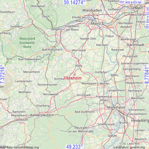
Ilbesheim GPS coordinates[2]
49° 41' 24" North, 8° 4' 31.008" East
| Map corner | latitude | longitude |
|---|---|---|
| Upper-left | 50.14274°, | 7.37216° |
| Center: | 49.69°, | 8.07528° |
| Lower-right: | 49.233°, | 8.77841° |
| Map W x H: | 101.2×101.2 km | = 62.9×62.9mi |
| max Lat: | 55.01917° ⇑71.6% North |
| Ilbesheim: | 49.69° |
| min Lat: | ⇓28.4% South 47.40724° |
| min Long | Ilbesheim | max Long |
| 5.92978° | 8.07528° | 14.98853° |
| W 24.2%⇐ | ⇒75.8% E |
Elevation
Elevation of Ilbesheim is 294 m = 965 ft, and this is 44.9 m = 147 ft above average elevation for this country.
| Max E: |
1256 m = 4121 ft | 39.3% |
| Ilbesheim | 294 m 965 ft | |
| Avg. | 249.1 m = 817 ft | |
Min E: |
-5 m = -16 ft | 60.7% |
See also: Germany elevation on elevation.city.
Geographical zone
Ilbesheim is located in North temperate zone (between Tropic of Cancer and the Arctic Circle). Distance of this North polar circle is 1876.2 km =1165.8 mi to North.| Distance of | km | miles | from Ilbesheim |
|---|---|---|---|
| North Pole | 4482.1 | 2785 | to North |
| Arctic Circle | 1876.2 | 1165.8 | to North |
| Tropic Cancer | 2919.1 | 1813.8 | to South |
| Equator | 5525 | 3433.1 | to South |


Nearby cities:
15 places around Ilbesheim: (largest is in red/bold)
• Albisheim
4.7 km =2.9 mi,  163°
163°
• Bischheim
3.8 km =2.4 mi,  234°
234°
• Dintesheim
5.3 km =3.3 mi,  68°
68°
• Esselborn
4.2 km =2.6 mi,  47°
47°
• Flomborn
5.3 km =3.3 mi,  89°
89°
• Freimersheim
2.3 km =1.4 mi,  26°
26°
• Gauersheim
3.4 km =2.1 mi,  184°
184°
• Kettenheim
4.5 km =2.8 mi,  37°
37°
• Kirchheimbolanden
5.3 km =3.3 mi, 234°
• Mauchenheim
3.8 km =2.4 mi,  326°
326°
• Morschheim
3.6 km =2.2 mi,  281°
281°
• Offenheim
5.1 km =3.2 mi,  320°
320°
• Rittersheim
3.1 km =1.9 mi,  203°
203°
• Stetten
2.6 km =1.6 mi,  152°
152°
• Wahlheim
3.8 km =2.4 mi, 35°
Sources, notices
• [Note1] Compared only with cities in Germany existing in our database
• [Src1] Map data: © OpenStreetMap contributors (CC-BY-SA)
• [Src2] Other city data from geonames.org with taken over terms of usage.
• [Src3] Geographical zone / Annual Mean Temperature by Robert A. Rohde @ Wikipedia
