Eschenlohe geodata
Eschenlohe (Bavaria) is a seat of a fourth-order administrative division; located in Germany in Europe/Berlin (GMT+2) time zone. In our database, there are 11009 cities with bigger population. Compared to other cities in Germany, 99.6% of cities are located further ↑North; 69.7% of cities are located further ←West and 96.3% of cities have lower elevation than Eschenlohe. Note1
Administrative division(s):
- Level 1: Bavaria
- Level 2: Upper Bavaria
- Level 3: Landkreis Garmisch-Partenkirchen
- Level 4: Eschenlohe


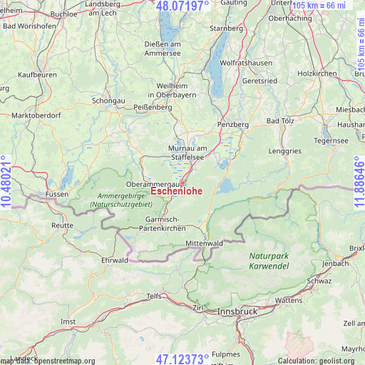
Eschenlohe GPS coordinates[2]
47° 36' 0" North, 11° 10' 59.988" East
| Map corner | latitude | longitude |
|---|---|---|
| Upper-left | 48.07197°, | 10.48021° |
| Center: | 47.6°, | 11.18333° |
| Lower-right: | 47.12373°, | 11.88646° |
| Map W x H: | 105.4×105.4 km | = 65.5×65.5mi |
| max Lat: | 55.01917° ⇑99.6% North |
| Eschenlohe: | 47.6° |
| min Lat: | ⇓0.4% South 47.40724° |
| min Long | Eschenlohe | max Long |
| 5.92978° | 11.18333° | 14.98853° |
| W 69.7%⇐ | ⇒30.3% E |
Elevation
Elevation of Eschenlohe is 637 m = 2090 ft, and this is 387.9 m = 1273 ft above average elevation for this country.
| Max E: |
1256 m = 4121 ft | 3.7% |
| Eschenlohe | 637 m 2090 ft | |
| Avg. | 249.1 m = 817 ft | |
Min E: |
-5 m = -16 ft | 96.3% |
See also: Germany elevation on elevation.city.
Geographical zone
Eschenlohe is located in North temperate zone (between Tropic of Cancer and the Arctic Circle). Distance of this North polar circle is 2108.6 km =1310.2 mi to North.| Distance of | km | miles | from Eschenlohe |
|---|---|---|---|
| North Pole | 4714.4 | 2929.4 | to North |
| Arctic Circle | 2108.6 | 1310.2 | to North |
| Tropic Cancer | 2686.7 | 1669.4 | to South |
| Equator | 5292.6 | 3288.7 | to South |


Nearby cities:
15 places around Eschenlohe: (largest is in red/bold)
• Bad Kohlgrub
12.4 km =7.7 mi,  306°
306°
• Ettal
7.3 km =4.5 mi,  239°
239°
• Farchant
9.4 km =5.8 mi,  214°
214°
• Großweil
12.2 km =7.6 mi,  46°
46°
• Krün
12.8 km =8 mi,  145°
145°
• Murnau am Staffelsee
9.1 km =5.7 mi,  8°
8°
• Oberammergau
8.7 km =5.4 mi,  268°
268°
• Oberau
5.6 km =3.5 mi,  216°
216°
• Ohlstadt
5.3 km =3.3 mi, 45°
• Riegsee
11.6 km =7.2 mi,  19°
19°
• Schlehdorf
11.8 km =7.3 mi,  56°
56°
• Schwaigen
3.1 km =1.9 mi, 306°
• Seehausen am Staffelsee
9.9 km =6.2 mi,  0°
0°
• Unterammergau
11.8 km =7.3 mi,  278°
278°
• Wallgau
11.9 km =7.4 mi,  140°
140°
Sources, notices
• [Note1] Compared only with cities in Germany existing in our database
• [Src1] Map data: © OpenStreetMap contributors (CC-BY-SA)
• [Src2] Other city data from geonames.org with taken over terms of usage.
• [Src3] Geographical zone / Annual Mean Temperature by Robert A. Rohde @ Wikipedia
