Farchant geodata
Farchant (Bavaria) is a seat of a fourth-order administrative division; located in Germany in Europe/Berlin (GMT+2) time zone. With population of 3,722 people, there are 3459 cities with bigger population in this country. Compared to other cities in Germany, 99.9% of cities are located further ↑North; 68.5% of cities are located further ←West and 97.2% of cities have lower elevation than Farchant. Note1
Administrative division(s):
- Level 1: Bavaria
- Level 2: Upper Bavaria
- Level 3: Landkreis Garmisch-Partenkirchen
- Level 4: Farchant


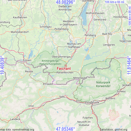
Farchant GPS coordinates[2]
47° 31' 49.296" North, 11° 6' 41.436" East
| Map corner | latitude | longitude |
|---|---|---|
| Upper-left | 48.00296°, | 10.40839° |
| Center: | 47.53036°, | 11.11151° |
| Lower-right: | 47.05346°, | 11.81464° |
| Map W x H: | 105.6×105.6 km | = 65.6×65.6mi |
| max Lat: | 55.01917° ⇑99.9% North |
| Farchant: | 47.53036° |
| min Lat: | ⇓0.1% South 47.40724° |
| min Long | Farchant | max Long |
| 5.92978° | 11.11151° | 14.98853° |
| W 68.5%⇐ | ⇒31.5% E |
Elevation
Elevation of Farchant is 671 m = 2201 ft, and this is 421.9 m = 1384 ft above average elevation for this country.
| Max E: |
1256 m = 4121 ft | 2.8% |
| Farchant | 671 m 2201 ft | |
| Avg. | 249.1 m = 817 ft | |
Min E: |
-5 m = -16 ft | 97.2% |
See also: Germany elevation on elevation.city.
Geographical zone
Farchant is located in North temperate zone (between Tropic of Cancer and the Arctic Circle). Distance of this North polar circle is 2116.3 km =1315 mi to North.| Distance of | km | miles | from Farchant |
|---|---|---|---|
| North Pole | 4722.2 | 2934.2 | to North |
| Arctic Circle | 2116.3 | 1315 | to North |
| Tropic Cancer | 2679 | 1664.7 | to South |
| Equator | 5284.9 | 3283.9 | to South |


Nearby cities:
15 places around Farchant: (largest is in red/bold)
• Bad Kohlgrub
15.8 km =9.8 mi,  343°
343°
• Eschenlohe
9.4 km =5.8 mi,  34°
34°
• Ettal
4.1 km =2.5 mi,  347°
347°
• Garmisch-Partenkirchen
4.4 km =2.7 mi,  195°
195°
• Grainau
8.9 km =5.5 mi,  227°
227°
• Krün
12.9 km =8 mi,  102°
102°
• Mittenwald
15 km =9.3 mi,  130°
130°
• Murnau am Staffelsee
18 km =11.2 mi,  21°
21°
• Oberammergau
8.2 km =5.1 mi, 336°
• Oberau
3.9 km =2.4 mi, 32°
• Ohlstadt
14.6 km =9.1 mi,  38°
38°
• Saulgrub
16.5 km =10.3 mi, 336°
• Schwaigen
10 km =6.2 mi, 16°
• Unterammergau
11.5 km =7.1 mi,  326°
326°
• Wallgau
13 km =8.1 mi, 96°
Sources, notices
• [Note1] Compared only with cities in Germany existing in our database
• [Src1] Map data: © OpenStreetMap contributors (CC-BY-SA)
• [Src2] Other city data from geonames.org with taken over terms of usage.
• [Src3] Geographical zone / Annual Mean Temperature by Robert A. Rohde @ Wikipedia
