Egesheim geodata
Egesheim (Baden-Württemberg) is a seat of a fourth-order administrative division; located in Germany in Europe/Berlin (GMT+2) time zone. With population of 632 people, there are 8638 cities with bigger population in this country. Compared to other cities in Germany, 93.8% of cities are located further ↑North; 67.2% of cities are located further →East and 98.3% of cities have lower elevation than Egesheim. Note1
Administrative division(s):
- Level 1: Baden-Württemberg
- Level 2: Freiburg Region
- Level 3: Landkreis Tuttlingen
- Level 4: Egesheim


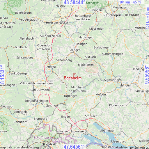
Egesheim GPS coordinates[2]
48° 7' 1.812" North, 8° 51' 23.184" East
| Map corner | latitude | longitude |
|---|---|---|
| Upper-left | 48.58444°, | 8.15331° |
| Center: | 48.11717°, | 8.85644° |
| Lower-right: | 47.64561°, | 9.55956° |
| Map W x H: | 104.4×104.4 km | = 64.9×64.9mi |
| max Lat: | 55.01917° ⇑93.8% North |
| Egesheim: | 48.11717° |
| min Lat: | ⇓6.2% South 47.40724° |
| min Long | Egesheim | max Long |
| 5.92978° | 8.85644° | 14.98853° |
| W 32.8%⇐ | ⇒67.2% E |
Elevation
Elevation of Egesheim is 722 m = 2369 ft, and this is 472.9 m = 1552 ft above average elevation for this country.
| Max E: |
1256 m = 4121 ft | 1.7% |
| Egesheim | 722 m 2369 ft | |
| Avg. | 249.1 m = 817 ft | |
Min E: |
-5 m = -16 ft | 98.3% |
See also: Germany elevation on elevation.city.
Geographical zone
Egesheim is located in North temperate zone (between Tropic of Cancer and the Arctic Circle). Distance of this North polar circle is 2051 km =1274.4 mi to North.| Distance of | km | miles | from Egesheim |
|---|---|---|---|
| North Pole | 4656.9 | 2893.7 | to North |
| Arctic Circle | 2051 | 1274.4 | to North |
| Tropic Cancer | 2744.2 | 1705.2 | to South |
| Equator | 5350.1 | 3324.4 | to South |


Nearby cities:
15 places around Egesheim: (largest is in red/bold)
• Balgheim
8.7 km =5.4 mi,  229°
229°
• Bubsheim
1.7 km =1.1 mi,  268°
268°
• Bärenthal
8 km =5 mi,  134°
134°
• Böttingen
4.6 km =2.9 mi,  245°
245°
• Deilingen
8.2 km =5.1 mi,  320°
320°
• Denkingen
8.8 km =5.5 mi, 265°
• Dürbheim
8.2 km =5.1 mi,  214°
214°
• Gosheim
7.8 km =4.8 mi,  284°
284°
• Kolbingen
7.6 km =4.7 mi,  161°
161°
• Königsheim
2.1 km =1.3 mi, 158°
• Nusplingen
3.1 km =1.9 mi,  56°
56°
• Obernheim
5.1 km =3.2 mi,  3°
3°
• Reichenbach am Heuberg
1.9 km =1.2 mi,  345°
345°
• Renquishausen
5 km =3.1 mi,  139°
139°
• Wehingen
5.7 km =3.5 mi,  303°
303°
Sources, notices
• [Note1] Compared only with cities in Germany existing in our database
• [Src1] Map data: © OpenStreetMap contributors (CC-BY-SA)
• [Src2] Other city data from geonames.org with taken over terms of usage.
• [Src3] Geographical zone / Annual Mean Temperature by Robert A. Rohde @ Wikipedia
