Edingen-Neckarhausen geodata
Edingen-Neckarhausen (Baden-Württemberg) is a seat of a fourth-order administrative division; located in Germany in Europe/Berlin (GMT+2) time zone. With population of 14,009 people, there are 1135 cities with bigger population in this country. Compared to other cities in Germany, 76.4% of cities are located further ↑North; 70.1% of cities are located further →East and 67.4% of cities have higher elevation than Edingen-Neckarhausen. Note1
Administrative division(s):
- Level 1: Baden-Württemberg
- Level 2: Karlsruhe Region
- Level 3: Rhein-Neckar-Kreis
- Level 4: Edingen-Neckarhausen


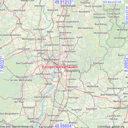
Edingen-Neckarhausen GPS coordinates[2]
49° 27' 25.992" North, 8° 36' 23.004" East
| Map corner | latitude | longitude |
|---|---|---|
| Upper-left | 49.91213°, | 7.90327° |
| Center: | 49.45722°, | 8.60639° |
| Lower-right: | 48.99804°, | 9.30952° |
| Map W x H: | 101.6×101.6 km | = 63.1×63.1mi |
| max Lat: | 55.01917° ⇑76.4% North |
| Edingen-Neckarhausen: | 49.45722° |
| min Lat: | ⇓23.6% South 47.40724° |
| min Long | Edingen-Neckarh | max Long |
| 5.92978° | 8.60639° | 14.98853° |
| W 29.9%⇐ | ⇒70.1% E |
Elevation
Elevation of Edingen-Neckarhausen is 105 m = 344 ft, and this is 144.1 m = 473 ft below average elevation for this country.
| Max E: |
1256 m = 4121 ft | 67.4% |
| Avg. | 249.1 m = 817 ft | |
| Edingen-Neckarhausen | 105 m = 344 ft | |
Min E: |
-5 m = -16 ft | 32.6% |
See also: Germany elevation on elevation.city.
Geographical zone
Edingen-Neckarhausen is located in North temperate zone (between Tropic of Cancer and the Arctic Circle). Distance of this North polar circle is 1902 km =1181.8 mi to North.| Distance of | km | miles | from Edingen-Neckarhausen |
|---|---|---|---|
| North Pole | 4507.9 | 2801.1 | to North |
| Arctic Circle | 1902 | 1181.8 | to North |
| Tropic Cancer | 2893.2 | 1797.8 | to South |
| Equator | 5499.1 | 3417 | to South |


Nearby cities:
15 places around Edingen-Neckarhausen: (largest is in red/bold)
• Altrip
8.4 km =5.2 mi,  253°
253°
• Brühl
8.5 km =5.3 mi,  218°
218°
• Dossenheim
5 km =3.1 mi,  98°
98°
• Eppelheim
6.5 km =4 mi,  160°
160°
• Heddesheim
5.4 km =3.4 mi,  357°
357°
• Heidelberg
8.2 km =5.1 mi,  132°
132°
• Hirschberg an der Bergstraße
6.6 km =4.1 mi,  33°
33°
• Ilvesheim
3.4 km =2.1 mi,  303°
303°
• Ladenburg
1.8 km =1.1 mi,  6°
6°
• Oftersheim
10.4 km =6.5 mi,  189°
189°
• Plankstadt
7 km =4.3 mi, 186°
• Schriesheim
4.5 km =2.8 mi,  66°
66°
• Schwetzingen
8.5 km =5.3 mi, 191°
• Viernheim
9.5 km =5.9 mi,  347°
347°
• Wilhelmsfeld
10.7 km =6.6 mi,  82°
82°
Sources, notices
• [Note1] Compared only with cities in Germany existing in our database
• [Src1] Map data: © OpenStreetMap contributors (CC-BY-SA)
• [Src2] Other city data from geonames.org with taken over terms of usage.
• [Src3] Geographical zone / Annual Mean Temperature by Robert A. Rohde @ Wikipedia
