Dörscheid geodata
Dörscheid (Rheinland-Pfalz) is a seat of a fourth-order administrative division; located in Germany in Europe/Berlin (GMT+2) time zone. With population of 455 people, there are 9523 cities with bigger population in this country. Compared to other cities in Germany, 61.4% of cities are located further ↑North; 82.1% of cities are located further →East and 57.4% of cities have higher elevation than Dörscheid. Note1


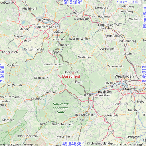
Dörscheid GPS coordinates[2]
50° 6' 0" North, 7° 45' 0" East
| Map corner | latitude | longitude |
|---|---|---|
| Upper-left | 50.5489°, | 7.04688° |
| Center: | 50.1°, | 7.75° |
| Lower-right: | 49.64686°, | 8.45313° |
| Map W x H: | 100.3×100.3 km | = 62.3×62.3mi |
| max Lat: | 55.01917° ⇑61.4% North |
| Dörscheid: | 50.1° |
| min Lat: | ⇓38.6% South 47.40724° |
| min Long | Dörscheid | max Long |
| 5.92978° | 7.75° | 14.98853° |
| W 17.9%⇐ | ⇒82.1% E |
Elevation
Elevation of Dörscheid is 172 m = 564 ft, and this is 77.1 m = 253 ft below average elevation for this country.
| Max E: |
1256 m = 4121 ft | 57.4% |
| Avg. | 249.1 m = 817 ft | |
| Dörscheid | 172 m = 564 ft | |
Min E: |
-5 m = -16 ft | 42.6% |
See also: Germany elevation on elevation.city.
Geographical zone
Dörscheid is located in North temperate zone (between Tropic of Cancer and the Arctic Circle). Distance of this North polar circle is 1830.6 km =1137.5 mi to North.| Distance of | km | miles | from Dörscheid |
|---|---|---|---|
| North Pole | 4436.5 | 2756.7 | to North |
| Arctic Circle | 1830.6 | 1137.5 | to North |
| Tropic Cancer | 2964.7 | 1842.2 | to South |
| Equator | 5570.6 | 3461.4 | to South |


Nearby cities:
15 places around Dörscheid: (largest is in red/bold)
• Bacharach
5 km =3.1 mi,  163°
163°
• Bornich
3.2 km =2 mi,  20°
20°
• Breitscheid
6.6 km =4.1 mi,  212°
212°
• Damscheid
4.8 km =3 mi,  270°
270°
• Kaub
1.5 km =0.9 mi,  149°
149°
• Niederburg
4 km =2.5 mi,  297°
297°
• Oberwesel
2 km =1.2 mi, 296°
• Patersberg
5.7 km =3.5 mi,  347°
347°
• Perscheid
5.1 km =3.2 mi,  223°
223°
• Reichenberg
5.7 km =3.5 mi,  12°
12°
• Reitzenhain
6 km =3.7 mi, 23°
• Sankt Goar
6.2 km =3.9 mi,  330°
330°
• Sauerthal
5.3 km =3.3 mi,  107°
107°
• Urbar
4.4 km =2.7 mi, 327°
• Weisel
4 km =2.5 mi,  62°
62°
Sources, notices
• [Note1] Compared only with cities in Germany existing in our database
• [Src1] Map data: © OpenStreetMap contributors (CC-BY-SA)
• [Src2] Other city data from geonames.org with taken over terms of usage.
• [Src3] Geographical zone / Annual Mean Temperature by Robert A. Rohde @ Wikipedia
