Dahmen geodata
Dahmen (Mecklenburg-Vorpommern) is a populated place; located in Germany in Europe/Berlin (GMT+2) time zone. With population of 621 people, there are 8713 cities with bigger population in this country. Compared to other cities in Germany, 87.9% of cities are located further ↓South; 88.6% of cities are located further ←West and 93.1% of cities have higher elevation than Dahmen. Note1
Administrative division(s):
- Level 1: Mecklenburg-Vorpommern
- Level 3: Landkreis Rostock
- Level 4: Dahmen


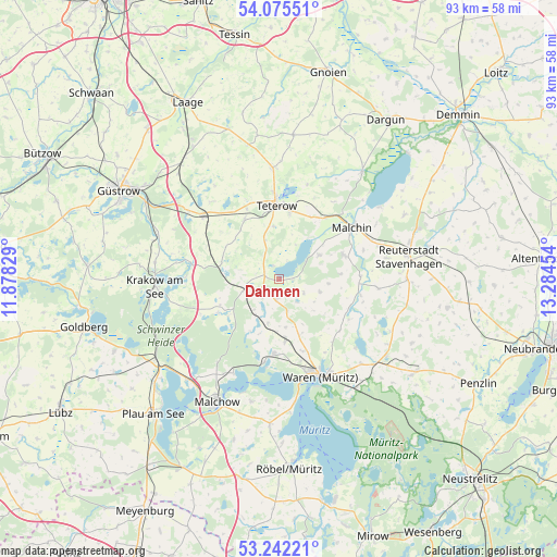
Dahmen GPS coordinates[2]
53° 39' 39.312" North, 12° 34' 53.076" East
| Map corner | latitude | longitude |
|---|---|---|
| Upper-left | 54.07551°, | 11.87829° |
| Center: | 53.66092°, | 12.58141° |
| Lower-right: | 53.24221°, | 13.28454° |
| Map W x H: | 92.7×92.7 km | = 57.6×57.6mi |
| max Lat: | 55.01917° ⇑12.1% North |
| Dahmen: | 53.66092° |
| min Lat: | ⇓87.9% South 47.40724° |
| min Long | Dahmen | max Long |
| 5.92978° | 12.58141° | 14.98853° |
| W 88.6%⇐ | ⇒11.4% E |
Elevation
Elevation of Dahmen is 13 m = 43 ft, and this is 236.1 m = 775 ft below average elevation for this country.
| Max E: |
1256 m = 4121 ft | 93.1% |
| Avg. | 249.1 m = 817 ft | |
| Dahmen | 13 m = 43 ft | |
Min E: |
-5 m = -16 ft | 6.9% |
See also: Germany elevation on elevation.city.
Geographical zone
Dahmen is located in North temperate zone (between Tropic of Cancer and the Arctic Circle). Distance of this North polar circle is 1434.6 km =891.4 mi to North.| Distance of | km | miles | from Dahmen |
|---|---|---|---|
| North Pole | 4040.5 | 2510.6 | to North |
| Arctic Circle | 1434.6 | 891.4 | to North |
| Tropic Cancer | 3360.6 | 2088.2 | to South |
| Equator | 5966.5 | 3707.4 | to South |


Nearby cities:
15 places around Dahmen: (largest is in red/bold)
• Basedow
7.7 km =4.8 mi,  57°
57°
• Faulenrost
13.8 km =8.6 mi,  100°
100°
• Gielow
11.5 km =7.1 mi,  69°
69°
• Grabowhöfe
10.3 km =6.4 mi,  175°
175°
• Groß Roge
14 km =8.7 mi,  338°
338°
• Groß Wokern
11.6 km =7.2 mi,  329°
329°
• Hohen Wangelin
11.8 km =7.3 mi,  242°
242°
• Jabel
13.9 km =8.6 mi,  190°
190°
• Langhagen
10 km =6.2 mi,  286°
286°
• Pampow
10.6 km =6.6 mi,  9°
9°
• Remplin
12.8 km =8 mi,  36°
36°
• Tessenow
5.5 km =3.4 mi, 5°
• Teterow
12.7 km =7.9 mi,  358°
358°
• Vielist
12.5 km =7.8 mi,  162°
162°
• Vollrathsruhe
6.4 km =4 mi,  252°
252°
Sources, notices
• [Note1] Compared only with cities in Germany existing in our database
• [Src1] Map data: © OpenStreetMap contributors (CC-BY-SA)
• [Src2] Other city data from geonames.org with taken over terms of usage.
• [Src3] Geographical zone / Annual Mean Temperature by Robert A. Rohde @ Wikipedia
