Vollrathsruhe geodata
Vollrathsruhe (Mecklenburg-Vorpommern) is a populated place; located in Germany in Europe/Berlin (GMT+2) time zone. With population of 545 people, there are 9114 cities with bigger population in this country. Compared to other cities in Germany, 87.6% of cities are located further ↓South; 87.9% of cities are located further ←West and 69.7% of cities have higher elevation than Vollrathsruhe. Note1
Administrative division(s):
- Level 1: Mecklenburg-Vorpommern
- Level 3: Mecklenburgische Seenplatte
- Level 4: Vollrathsruhe


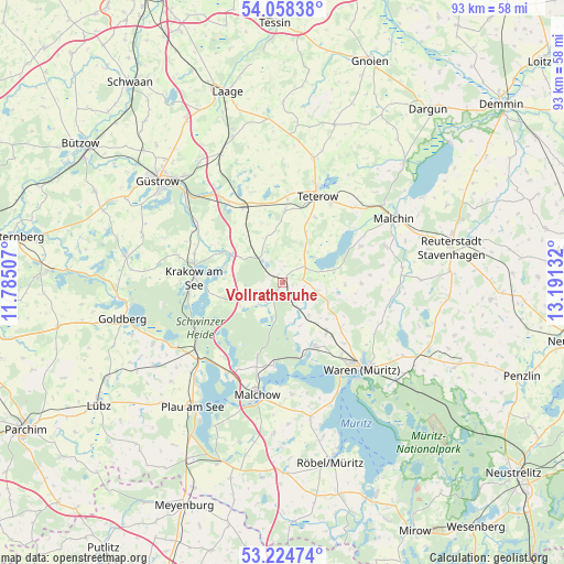
Vollrathsruhe GPS coordinates[2]
53° 38' 37.032" North, 12° 29' 17.484" East
| Map corner | latitude | longitude |
|---|---|---|
| Upper-left | 54.05838°, | 11.78507° |
| Center: | 53.64362°, | 12.48819° |
| Lower-right: | 53.22474°, | 13.19132° |
| Map W x H: | 92.7×92.7 km | = 57.6×57.6mi |
| max Lat: | 55.01917° ⇑12.4% North |
| Vollrathsruhe: | 53.64362° |
| min Lat: | ⇓87.6% South 47.40724° |
| min Long | Vollrathsruhe | max Long |
| 5.92978° | 12.48819° | 14.98853° |
| W 87.9%⇐ | ⇒12.1% E |
Elevation
Elevation of Vollrathsruhe is 93 m = 305 ft, and this is 156.1 m = 512 ft below average elevation for this country.
| Max E: |
1256 m = 4121 ft | 69.7% |
| Avg. | 249.1 m = 817 ft | |
| Vollrathsruhe | 93 m = 305 ft | |
Min E: |
-5 m = -16 ft | 30.3% |
See also: Germany elevation on elevation.city.
Geographical zone
Vollrathsruhe is located in North temperate zone (between Tropic of Cancer and the Arctic Circle). Distance of this North polar circle is 1436.6 km =892.7 mi to North.| Distance of | km | miles | from Vollrathsruhe |
|---|---|---|---|
| North Pole | 4042.5 | 2511.9 | to North |
| Arctic Circle | 1436.6 | 892.7 | to North |
| Tropic Cancer | 3358.7 | 2087 | to South |
| Equator | 5964.6 | 3706.2 | to South |


Nearby cities:
15 places around Vollrathsruhe: (largest is in red/bold)
• Basedow
14 km =8.7 mi,  64°
64°
• Dahmen
6.4 km =4 mi,  72°
72°
• Grabowhöfe
10.9 km =6.8 mi,  139°
139°
• Groß Roge
15 km =9.3 mi,  4°
4°
• Groß Wokern
12 km =7.5 mi, 1°
• Hohen Wangelin
5.6 km =3.5 mi,  230°
230°
• Jabel
12.4 km =7.7 mi,  162°
162°
• Krakow am See
14.4 km =8.9 mi,  273°
273°
• Kuchelmiß
9.4 km =5.8 mi,  297°
297°
• Lalendorf
14.2 km =8.8 mi,  332°
332°
• Langhagen
5.8 km =3.6 mi,  324°
324°
• Nossentiner Hütte
12.9 km =8 mi,  199°
199°
• Pampow
14.7 km =9.1 mi,  32°
32°
• Tessenow
10 km =6.2 mi,  42°
42°
• Vielist
14.1 km =8.8 mi, 135°
Sources, notices
• [Note1] Compared only with cities in Germany existing in our database
• [Src1] Map data: © OpenStreetMap contributors (CC-BY-SA)
• [Src2] Other city data from geonames.org with taken over terms of usage.
• [Src3] Geographical zone / Annual Mean Temperature by Robert A. Rohde @ Wikipedia
