Coswig geodata
Coswig (Saxony-Anhalt) is a populated place; located in Germany in Europe/Berlin (GMT+2) time zone. With population of 8,495 people, there are 1876 cities with bigger population in this country. Compared to other cities in Germany, 70.9% of cities are located further ↓South; 87.5% of cities are located further ←West and 72% of cities have higher elevation than Coswig. Note1
Administrative division(s):
- Level 1: Saxony-Anhalt
- Level 3: Landkreis Wittenberg
- Level 4: Coswig (Anhalt)


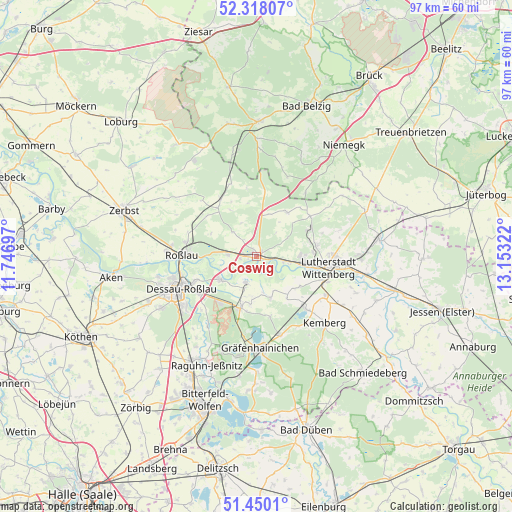
Coswig GPS coordinates[2]
51° 53' 10.248" North, 12° 27' 0.324" East
| Map corner | latitude | longitude |
|---|---|---|
| Upper-left | 52.31807°, | 11.74697° |
| Center: | 51.88618°, | 12.45009° |
| Lower-right: | 51.4501°, | 13.15322° |
| Map W x H: | 96.5×96.5 km | = 60×60mi |
| max Lat: | 55.01917° ⇑29.1% North |
| Coswig: | 51.88618° |
| min Lat: | ⇓70.9% South 47.40724° |
| min Long | Coswig | max Long |
| 5.92978° | 12.45009° | 14.98853° |
| W 87.5%⇐ | ⇒12.5% E |
Elevation
Elevation of Coswig is 78 m = 256 ft, and this is 171.1 m = 561 ft below average elevation for this country.
| Max E: |
1256 m = 4121 ft | 72% |
| Avg. | 249.1 m = 817 ft | |
| Coswig | 78 m = 256 ft | |
Min E: |
-5 m = -16 ft | 28% |
See also: Germany elevation on elevation.city.
Geographical zone
Coswig is located in North temperate zone (between Tropic of Cancer and the Arctic Circle). Distance of this North polar circle is 1632 km =1014.1 mi to North.| Distance of | km | miles | from Coswig |
|---|---|---|---|
| North Pole | 4237.9 | 2633.3 | to North |
| Arctic Circle | 1632 | 1014.1 | to North |
| Tropic Cancer | 3163.3 | 1965.6 | to South |
| Equator | 5769.2 | 3584.8 | to South |


Nearby cities:
15 places around Coswig: (largest is in red/bold)
• Apollensdorf
7 km =4.3 mi,  99°
99°
• Apollensdorf-Nord
8.3 km =5.2 mi,  87°
87°
• Cobbelsdorf
9.9 km =6.2 mi,  33°
33°
• Dobien
11.2 km =7 mi,  79°
79°
• Griebo
4.1 km =2.5 mi, 97°
• Horstdorf
7.5 km =4.7 mi,  191°
191°
• Kakau
9.2 km =5.7 mi, 187°
• Klieken
5.5 km =3.4 mi,  272°
272°
• Nudersdorf
11.1 km =6.9 mi,  63°
63°
• Oranienbaum
10.2 km =6.3 mi,  197°
197°
• Piesteritz
10.3 km =6.4 mi, 100°
• Reinsdorf
10.6 km =6.6 mi, 85°
• Rothemark
11.5 km =7.1 mi, 92°
• Vockerode
8 km =5 mi,  237°
237°
• Wörlitz
5.3 km =3.3 mi, 201°
Sources, notices
• [Note1] Compared only with cities in Germany existing in our database
• [Src1] Map data: © OpenStreetMap contributors (CC-BY-SA)
• [Src2] Other city data from geonames.org with taken over terms of usage.
• [Src3] Geographical zone / Annual Mean Temperature by Robert A. Rohde @ Wikipedia
