Klieken geodata
Klieken (Saxony-Anhalt) is a populated place; located in Germany in Europe/Berlin (GMT+2) time zone. With population of 1,111 people, there are 6818 cities with bigger population in this country. Compared to other cities in Germany, 71% of cities are located further ↓South; 86.6% of cities are located further ←West and 73.8% of cities have higher elevation than Klieken. Note1
Administrative division(s):
- Level 1: Saxony-Anhalt
- Level 3: Landkreis Wittenberg
- Level 4: Coswig (Anhalt)


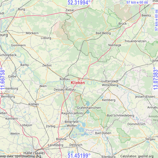
Klieken GPS coordinates[2]
51° 53' 17.016" North, 12° 22' 14.52" East
| Map corner | latitude | longitude |
|---|---|---|
| Upper-left | 52.31994°, | 11.66758° |
| Center: | 51.88806°, | 12.3707° |
| Lower-right: | 51.45199°, | 13.07383° |
| Map W x H: | 96.5×96.5 km | = 60×60mi |
| max Lat: | 55.01917° ⇑29% North |
| Klieken: | 51.88806° |
| min Lat: | ⇓71% South 47.40724° |
| min Long | Klieken | max Long |
| 5.92978° | 12.3707° | 14.98853° |
| W 86.6%⇐ | ⇒13.4% E |
Elevation
Elevation of Klieken is 68 m = 223 ft, and this is 181.1 m = 594 ft below average elevation for this country.
| Max E: |
1256 m = 4121 ft | 73.8% |
| Avg. | 249.1 m = 817 ft | |
| Klieken | 68 m = 223 ft | |
Min E: |
-5 m = -16 ft | 26.2% |
See also: Germany elevation on elevation.city.
Geographical zone
Klieken is located in North temperate zone (between Tropic of Cancer and the Arctic Circle). Distance of this North polar circle is 1631.8 km =1014 mi to North.| Distance of | km | miles | from Klieken |
|---|---|---|---|
| North Pole | 4237.7 | 2633.2 | to North |
| Arctic Circle | 1631.8 | 1014 | to North |
| Tropic Cancer | 3163.5 | 1965.7 | to South |
| Equator | 5769.4 | 3584.9 | to South |


Nearby cities:
15 places around Klieken: (largest is in red/bold)
• Apollensdorf
12.4 km =7.7 mi,  96°
96°
• Apollensdorf-Nord
13.7 km =8.5 mi,  89°
89°
• Cobbelsdorf
13.6 km =8.5 mi,  53°
53°
• Coswig
5.5 km =3.4 mi, 92°
• Dessau
10.2 km =6.3 mi,  237°
237°
• Griebo
9.5 km =5.9 mi, 94°
• Horstdorf
8.6 km =5.3 mi,  152°
152°
• Jeber-Bergfrieden
10.7 km =6.6 mi,  352°
352°
• Kakau
10.2 km =6.3 mi,  155°
155°
• Oranienbaum
10.2 km =6.3 mi,  166°
166°
• Rodleben
11.7 km =7.3 mi,  274°
274°
• Roßlau
8.8 km =5.5 mi, 269°
• Thießen
9 km =5.6 mi,  326°
326°
• Vockerode
4.7 km =2.9 mi,  195°
195°
• Wörlitz
6.2 km =3.9 mi, 146°
Sources, notices
• [Note1] Compared only with cities in Germany existing in our database
• [Src1] Map data: © OpenStreetMap contributors (CC-BY-SA)
• [Src2] Other city data from geonames.org with taken over terms of usage.
• [Src3] Geographical zone / Annual Mean Temperature by Robert A. Rohde @ Wikipedia
