Bullay geodata
Bullay (Rheinland-Pfalz) is a seat of a fourth-order administrative division; located in Germany in Europe/Berlin (GMT+2) time zone. With population of 1,531 people, there are 5822 cities with bigger population in this country. Compared to other cities in Germany, 62.3% of cities are located further ↑North; 92% of cities are located further →East and 62.7% of cities have higher elevation than Bullay. Note1


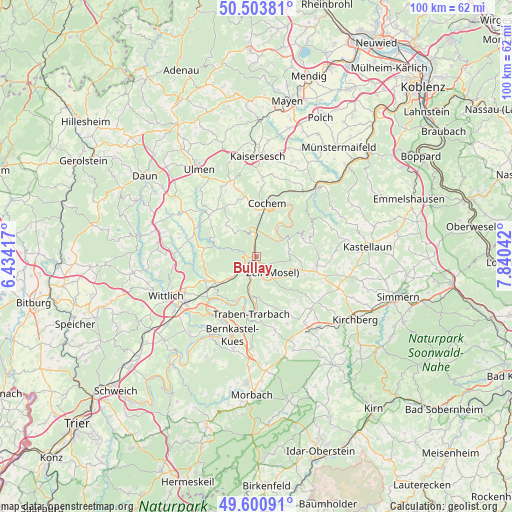
Bullay GPS coordinates[2]
50° 3' 16.128" North, 7° 8' 14.28" East
| Map corner | latitude | longitude |
|---|---|---|
| Upper-left | 50.50381°, | 6.43417° |
| Center: | 50.05448°, | 7.1373° |
| Lower-right: | 49.60091°, | 7.84042° |
| Map W x H: | 100.4×100.4 km | = 62.4×62.4mi |
| max Lat: | 55.01917° ⇑62.3% North |
| Bullay: | 50.05448° |
| min Lat: | ⇓37.7% South 47.40724° |
| min Long | Bullay | max Long |
| 5.92978° | 7.1373° | 14.98853° |
| W 8%⇐ | ⇒92% E |
Elevation
Elevation of Bullay is 134 m = 440 ft, and this is 115.1 m = 378 ft below average elevation for this country.
| Max E: |
1256 m = 4121 ft | 62.7% |
| Avg. | 249.1 m = 817 ft | |
| Bullay | 134 m = 440 ft | |
Min E: |
-5 m = -16 ft | 37.3% |
See also: Germany elevation on elevation.city.
Geographical zone
Bullay is located in North temperate zone (between Tropic of Cancer and the Arctic Circle). Distance of this North polar circle is 1835.6 km =1140.6 mi to North.| Distance of | km | miles | from Bullay |
|---|---|---|---|
| North Pole | 4441.5 | 2759.8 | to North |
| Arctic Circle | 1835.6 | 1140.6 | to North |
| Tropic Cancer | 2959.6 | 1839 | to South |
| Equator | 5565.5 | 3458.2 | to South |


Nearby cities:
15 places around Bullay: (largest is in red/bold)
• Alf
1 km =0.6 mi,  270°
270°
• Bengel
6.6 km =4.1 mi,  230°
230°
• Beuren
6.4 km =4 mi,  322°
322°
• Bremm
5.3 km =3.3 mi,  343°
343°
• Briedel
4.3 km =2.7 mi,  167°
167°
• Briedern
6.8 km =4.2 mi,  41°
41°
• Ediger-Eller
7 km =4.3 mi,  7°
7°
• Mesenich
6.8 km =4.2 mi, 41°
• Neef
5.1 km =3.2 mi,  356°
356°
• Nehren
5.5 km =3.4 mi,  54°
54°
• Pünderich
1.7 km =1.1 mi,  202°
202°
• Reil
4.5 km =2.8 mi, 199°
• Sankt Aldegund
3.2 km =2 mi,  354°
354°
• Senheim
6.5 km =4 mi,  60°
60°
• Zell
4.3 km =2.7 mi,  131°
131°
Sources, notices
• [Note1] Compared only with cities in Germany existing in our database
• [Src1] Map data: © OpenStreetMap contributors (CC-BY-SA)
• [Src2] Other city data from geonames.org with taken over terms of usage.
• [Src3] Geographical zone / Annual Mean Temperature by Robert A. Rohde @ Wikipedia
