Pünderich geodata
Pünderich (Rheinland-Pfalz) is a seat of a fourth-order administrative division; located in Germany in Europe/Berlin (GMT+2) time zone. With population of 953 people, there are 7337 cities with bigger population in this country. Compared to other cities in Germany, 62.6% of cities are located further ↑North; 92.1% of cities are located further →East and 66% of cities have higher elevation than Pünderich. Note1
Administrative division(s):
- Level 1: Rheinland-Pfalz
- Level 3: Landkreis Cochem-Zell
- Level 4: Pünderich


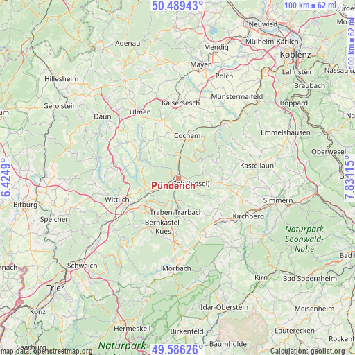
Pünderich GPS coordinates[2]
50° 2' 23.892" North, 7° 7' 40.908" East
| Map corner | latitude | longitude |
|---|---|---|
| Upper-left | 50.48943°, | 6.4249° |
| Center: | 50.03997°, | 7.12803° |
| Lower-right: | 49.58626°, | 7.83115° |
| Map W x H: | 100.4×100.4 km | = 62.4×62.4mi |
| max Lat: | 55.01917° ⇑62.6% North |
| Pünderich: | 50.03997° |
| min Lat: | ⇓37.4% South 47.40724° |
| min Long | Pünderich | max Long |
| 5.92978° | 7.12803° | 14.98853° |
| W 7.9%⇐ | ⇒92.1% E |
Elevation
Elevation of Pünderich is 114 m = 374 ft, and this is 135.1 m = 443 ft below average elevation for this country.
| Max E: |
1256 m = 4121 ft | 66% |
| Avg. | 249.1 m = 817 ft | |
| Pünderich | 114 m = 374 ft | |
Min E: |
-5 m = -16 ft | 34% |
See also: Germany elevation on elevation.city.
Geographical zone
Pünderich is located in North temperate zone (between Tropic of Cancer and the Arctic Circle). Distance of this North polar circle is 1837.3 km =1141.6 mi to North.| Distance of | km | miles | from Pünderich |
|---|---|---|---|
| North Pole | 4443.1 | 2760.8 | to North |
| Arctic Circle | 1837.3 | 1141.6 | to North |
| Tropic Cancer | 2958 | 1838 | to South |
| Equator | 5563.9 | 3457.2 | to South |


Nearby cities:
15 places around Pünderich: (largest is in red/bold)
• Alf
1.7 km =1.1 mi,  348°
348°
• Bad Bertrich
7.4 km =4.6 mi,  293°
293°
• Bengel
5.1 km =3.2 mi,  239°
239°
• Beuren
7.4 km =4.6 mi,  334°
334°
• Bremm
6.7 km =4.2 mi, 353°
• Briedel
3 km =1.9 mi,  148°
148°
• Bullay
1.7 km =1.1 mi,  22°
22°
• Enkirch
6.2 km =3.9 mi,  178°
178°
• Kröv
7.1 km =4.4 mi,  206°
206°
• Neef
6.7 km =4.2 mi,  3°
3°
• Nehren
7 km =4.3 mi,  46°
46°
• Reil
2.7 km =1.7 mi,  197°
197°
• Sankt Aldegund
4.8 km =3 mi, 4°
• Senheim
8 km =5 mi, 52°
• Zell
4.1 km =2.5 mi,  107°
107°
Sources, notices
• [Note1] Compared only with cities in Germany existing in our database
• [Src1] Map data: © OpenStreetMap contributors (CC-BY-SA)
• [Src2] Other city data from geonames.org with taken over terms of usage.
• [Src3] Geographical zone / Annual Mean Temperature by Robert A. Rohde @ Wikipedia
